Where is Sakhalin. Sakhalin on the map of Russia, Sakhalin region. Where is the island, climate. Sakhalin Regional Museum of Local Lore
Sakhalin is the largest island in Russia, resting among the waters of the Sea of Okhotsk and the Sea of Japan.
With the very name of the island there was an embarrassment. The Japanese called it Karafuto, reproducing in its own way the name given to the island by its indigenous population - the Ainu. But the toponym "Sakhalin" appeared as a result of an error of unlucky cartographers. Since the travels of La Perouse, it has been believed that Sakhalin is a peninsula.
In the middle of the 19th century, the captain of the Baikal ship, G. Nevelsky, was able to go around Sakhalin. Naturally, it became necessary to make changes to existing geographical maps, which the cartographers did. They carefully copied the shape of the island and indicated its coordinates. And then - either the cartographer was busy and entrusted the matter to the student, or his glasses were with lower diopters than necessary, but what happened happened. Cartographers mistakenly took the autochthonous name of the Amur River - Sakhalyan Ulla, indicated in the previous map, for the name of the new island. So Sakhalin became Sakhalin. The name has taken root, and now even conservative Japanese are beginning to forget the former toponym "Karafuto".
Interesting! By the way, Sakhalin was discovered many times. The expeditions of Poyarkov, Kruzenshtern, Khvostov, Davydov and Laperouse went to him. All expeditions searched and found something of their own. La Perouse, for example, was looking for evidence of the existence of the legendary Tartaria. Therefore, he called the strait he discovered Tartar. Subsequently, "Tartar" turned into "Tatar". This can mislead an unprepared tourist, so it is worth clarifying that the Tatars have nothing to do with the history of the island.

Climate and weather on Sakhalin
The climate on Sakhalin is cool, determined by many geographical factors. Winters are snowy and long, imperceptibly turning into not very hot summers - excellent conditions for skiers and valuable varieties of fish. There are a great many of those and others on Sakhalin.


When is the best time to go to Sakhalin
The tourism industry of Sakhalin is a rare indicator for our country that it is possible to work not only on the use of natural gifts. There is a reason for this. The vast majority of tourists on Sakhalin are Japanese, who are difficult to attract with uncomplicated Soviet conditions for recreation. The Japanese demand good food and quality service. Therefore, comfortable hotels and a developed restaurant business have become the norm for Sakhalin. In addition, on Sakhalin, by attracting funds from Japanese investors, the following tourist infrastructure facilities have already been created and are still being created:
- Tourist complex "Hot Keys".
- Tourist base "Aquamarine".
- The historical center at the Japanese ancient temple "Karafuto Jinja".
- A massive tourist complex "Sakhalin City Center" is under construction, capable of attracting tourists from all over the world in the future.
With all the variety of modern infrastructure facilities, the possibility of ecotourism, beloved by many, with elements of survival remains.
Sakhalin, of course, is not a museum center, but still provides tourists with the opportunity to see something unusual, namely the South Sakhalin Museum of Railway Engineering. With many grown-up boys and girls of all nationalities retaining a reverent love for railroad toys, the museum has no shortage of visitors.


Ecotourism and health tourism
For lovers of ecotourism and hot healing springs, Sakhalin Island is a real find. Both natural monuments and thermal waters are abundant here.
natural attractions
- Seal Island is a protected area that can be reached as part of an excursion. The island has a world-famous fur seal rookery. In terms of the number of pinnipeds resting there, the Island has no analogues. Only the Commander Islands are comparable to it. A real paradise for zoologists, zoophotographers and ecotourists.
- Sakhalin amber deposits - Starodubsky and Vzmorsky beaches. Amber here can be harvested like berries. By the way, Sakhalin amber is really a berry, cherry shade.
- Nituisky waterfall, which is of particular interest during the spawning season of salmon.
- Stone idols of Cape Stukabis, carved from rocks of volcanic origin by nature itself. Here, near the cape, there is an ideal place for fishing, where successful fishermen caught hefty Amur whitefish. Depending on the season, you can watch the nesting of Japanese cormorants and the mating of St. John's sea lions. Also, Cape Stukabis is highly valued by esotericists, Buddhists and hunters of the elusive Shambhala. They say that the contemplation of the statues and the two rushing waterfalls plunges them into nirvana.
- Cape Lamanon is a real gift for ornithologists and amateur geologists. Rare Steller's sea eagles are found here, and mountains of volcanic origin give prospectors samples of quartz and calcite.


How to get to the thermal springs
There are many of them on Sakhalin, and in all of them you can swim and heal.
Popular ones include:
Sinegorsk hot springs, throwing out cubes of water with a complex chemical composition and a high content of arsenic. The type of Sinegorsk water is rare in the world and treats serious disorders of cell metabolism and the consequences of radiation sickness. Sinegorsk is located 20 km from Yuzhno-Sakhalinsk,
Balneological health centers they treat with mud of the Tatar (Tartar) Strait, namely the mouth of the Lechebnaya River and Lake Changeable. The mud of these natural health resorts save people with severe skin diseases and intractable skin ulcers. Mud procedures are carried out in:
- Yuzhno-Sakhalinsk sanatorium "Aralia" (Yuzhno-Sakhalinsk, Komsomolskaya st. 371).
- Sanatorium "Gornyak" (Yuzhno-Sakhalinsk, Gornaya st. 1).
- Sanatoriums "Chaika" and "Sakhalin". Located 20 km from Yuzhno-Sakhalinsk, near the Sinegorsk thermal springs.
Daginskiye hot waters help with arthritis, arthrosis and other troubles that affect the musculoskeletal system of humans and swans. In any case, the swans have chosen the Dagin thermal springs as their habitat and do not complain about illnesses.
Goryachiye Klyuchi is a village with the same name thermal springs. Getting there is easy. From Yuzhno-Sakhalinsk to Nogliki, and then 30 km following the signs to Klyuchi. The road is not of Japanese quality, unpaved, but the Japanese drive on it. Probably, they sometimes want the exotic. You can stop in the Keys themselves. Or you can go to Nogliki and go to Klyuchi for procedures. Most do just that, because after a ten-minute procedure in hot waters, there is absolutely nothing to do in the Keys, except to wander around the campground and play Bear Grylls. In Nogliki conditions are much more comfortable. There is a small hotel. The cost of the room exceeds 2000 rubles per day. In the private sector, a little cheaper - 1200 rubles per person per day.
The equipment of the hot springs in the Keys themselves varies. There are well-equipped, with clean sunbeds and neat walls. There are both running and wild. The best are those belonging to the Dagi cordon house. The cost of one procedure is 100 rubles. Wild springs are not equipped at all or are poorly equipped. Dilapidated walls, holes covered with cellophane tape, slippery deck chairs and a leaking roof. But each type of source has its fans.


Sakhalin for skiers
International ratings of ski resorts do not ignore Sakhalin. To the pride of the domestic tourism business, Sakhalin is far from being an outsider. Due to climatic conditions, the mountain snow cover of Sakhalin lasts up to 6 months a year, and thanks to Japanese investments, ski slopes and tourist camps are being equipped.
An interesting feature of Sakhalin ski tourism is the ability to combine business with pleasure. Speaking exaggeratedly, after descending from the mountain, you can ride to a geothermal spring and take a healing bath.
The tourist complex "Mountain Air" is located in the center of Yuzhno-Sakhalinsk, on Victory Square, on the slope of Mount Bolshevik. The complex operates from early December to mid-May.
Important! To ski on the slopes of the complex, you need to purchase either a weekly pass for 8,000 rubles or a one-day ski pass for 1,200 rubles. Skating is allowed from 9 am to 9 pm, the day off is Monday.
In total, the complex has 14 downhill slopes, good quality skis and snowboards are available for rent. On the territory there are funiculars, left-luggage offices, holiday houses, ski jumps, a children's room.
At the complex "Mountain Air" there are hotels with different levels of amenities and services provided. Tops the rating "Imperial Palace". The name is somewhat loud, but the hotel itself is quite good. Approximately equal to him in the rating of "Mitos" and "Santa Rizot". There are hotels that are simpler and, accordingly, cheaper, with names familiar to every post-Soviet person - Rubin and Gagarin. You can eat in several cafes on the territory of the complex and in hotel restaurants.


Food and nutrition
You can taste everything on Sakhalin that your heart desires. The food supply to the island is stable and plentiful. Due to the large number of Japanese and Chinese tourists with their own gastronomic preferences, there are many restaurants and cafes of Japanese and Chinese cuisine in Yuzhno-Sakhalinsk. Due to the geographical proximity of these countries, restaurant chefs have the opportunity to undergo internships in restaurants in Tokyo or Beijing, and the abundance of fish resources precludes the very concept of using any salted herring or mayonnaise in the manufacture of sushi. Therefore, sushi in Yuzhno-Sakhalinsk is really sushi, and not rice squares according to the recipe of the village vocational school. The same can be said about Chinese dishes.
Every South Sakhalin cafe has Korean cuisine. It has grown so firmly and long into the life of Sakhalin that it is a real culinary culture.

Interesting! A separate story about five-minute caviar, which has long become the hallmark of Sakhalin. In the season of catching chum salmon or pink salmon, the Sakhalin market explodes with an abundance of caviar. After gutting pink salmon, the Sakhalin people wash the caviar, roll it on cheesecloth and dip it in a strong saline solution. Then, in the same gauze, the solution is allowed to drain from the caviar. Five minutes is ready. You can sit at the table and eat with spoons. Tasty and healthy. But in most cases, it's expensive.
On Sakhalin it is a sin not to eat fish. Chum salmon, pink salmon, coho salmon, smelt, trepang, halibut, octopus - this is not a complete list of the Sakhalin fish abundance.
By autumn, Sakhalin enters the season for crabbing, and the markets are filled with huge crab claws hanging from the shelves.
Scallops are another Sakhalin delicacy, which is obtained in an artisanal way, wandering through the shallow sea and feeling for scallops with your feet. To fully enjoy their taste, it is better to eat them right on the shore, throwing scallops on the hot coals of a fire. The doors will immediately open, and inside there will be a piece of white and pink meat, which must be eaten piping hot.


Sakhalin for active tourists
The Kuril Islands are an integral part of the Sakhalin Region, and therefore trips to the Kuriles are among the services provided by travel agencies as part of a trip to Sakhalin. Helicopter travel over the Kuriles is one of the most expensive tours. The flight to Mount Spamberg, to an absolutely wild and secluded area near Lake Superior, is not inferior in cost.
A little cheaper is the possibility of group or individual hunting for bears, fur-bearing animals or deer.

Relatively inexpensive tours include hiking for mushrooms and berries, fishing or diving.
Travel agency "Imperial Tour" organizes trips for travelers on all-terrain vehicles and cars to places far from popular tourist routes.
The travel agency "Moguchi" is engaged in the organization of recreation for corporate clients. Tourists are guided by professional huntsmen who will accompany travelers on hikes around the island of Hirano. Tourists will be taught how to catch pink salmon, cook five-minute caviar, make fire, bake pink salmon on coals and do many other exciting things in the spirit of the Discovery Channel. True, according to Russian custom, guests will not only not be allowed to starve, but will even be deprived of the slightest opportunity to lose weight. Throughout the trip, tourists will receive first-class fresh food from fish and seafood. In between meals, travelers will be able to admire seal rookeries and cormorant flights. Still, a wild vacation with survival in Russian is very satisfying and tasty.


Conclusion
Theoretical physicists and just enthusiasts of this matter say that time travel is possible. Some refer to Tesla, some conduct experiments with speed and particles, however, success and victorious reports have not yet been heard. Apparently, because of this, the favorite argument of the temporary workers is moving into the past when traveling from west to east. It is enough to get on a plane at the right time, for example, in St. Petersburg and fly to Sakhalin. After a few hours of flight, the tourist will fall into yesterday. And returning back in the same way, will fall into tomorrow. During the experiment, a time traveler can have a very good rest at the numerous tourist bases of Sakhalin, swim in hot springs, catch fish and wander around the railway museum.
Located in the far east of Russia, the Sakhalin region includes islands, which can be clearly seen on the map. The region includes Sakhalin Island and the Kuril Islands.
Sakhalin is located off the eastern coast of the Eurasian continent. Its area is 76.6 thousand km 2. The island has an elongated shape in the north-south direction, about 950 km long.
From a geological point of view, Sakhalin is the northwestern part of the Pacific "Ring of Fire", which also includes the Kuriles and the Japanese Islands. The island formations included in the "ring of fire" are characterized by earthquakes, often destructive, as well as volcanic eruptions. There are volcanoes on Sakhalin - mud, not dangerous for people.
It is believed that the name of the island originated from the name of the Amur on an old map. The name "Sakhalyan-Ulla", belonging to the river and erroneously attributed to the island, was fixed thanks to later maps, where the island was called Sakhalin.
For residents of Japan, there is another name - the island of Karafuto. The island is surrounded by the Seas of Okhotsk and Japan. Between the island and the mainland there are 2 straits - Tatar and Nevel.
The Nevelskoy Strait is narrow, less than 7.5 km wide, covered with ice in winter. The Sea of Okhotsk and the Sea of Japan are connected by the La Perouse Strait, which separates the territory of Russia - Cape Crillon in the south of Sakhalin, from the northern Japanese island of Hokkaido. The strait is deep, on average 20-40 m, and wide (even in the narrowest part 43 km), which makes it convenient for navigation.
The relief of Sakhalin emphasizes its shape. Mountain ranges are stretched along the coasts, between them are low-lying areas. The northern part of the island is more low-lying, the southern part is predominantly mountainous with steep, rocky shores.
The coastline is indented, there are many small bays of rounded, elongated and bizarre shapes. Part of the bays are separated from the sea space by coastal ledges or islands.
How to get to Sakhalin
Sakhalin on the map of Russia gives an idea of the distance to it. The fastest way to get there is by plane. There are 2 options: fly to Yuzhno-Sakhalinsk or Vladivostok.
The most convenient way to get to the island is a non-stop flight from Moscow to Yuzhno-Sakhalinsk Airport. The flight takes about 8.5 hours. Modern liners are equipped with individual audio and video systems, each passenger has access to information about the flight. Travelers are provided with hot meals served twice. The time difference with Moscow is 8 hours.
If it was not possible to purchase a ticket for a direct flight, you can fly to the international airport in Vladivostok, then by plane 2 hours to Yuzhno-Sakhalinsk. 
Those wishing to see the country "from edge to edge" can be offered a train ride on the route Moscow - Vladivostok. There are 2 options: the branded train "Russia" and the tourist luxury class "Imperial Russia". The duration of the trip is at least 7 days. Then from Vladivostok in 2 hours by plane to Yuzhno-Sakhalinsk.
A more difficult option to get to Sakhalin is by ferry. The ferry service connects the mainland port of Vanino and the island port of Kholmsk. A regular bus runs between Kholmsk and Yuzhno-Sakhalinsk. You can get to Vanino by private transport, but the road is of poor quality.
You can get to Vanino by train from Khabarovsk - 1 day, from Vladivostok - 2 days. The journey by ferry takes about 12 hours. If desired, personal transport is loaded onto the ferry by prior reservation of a place for it. There is a gas station in Kholmsk, the A-392 highway will lead to Yuzhno-Sakhalinsk in an hour.
List of districts of the Sakhalin region with cities
Sakhalin on the map of Russia shows the ratio of its area and the total area of the Kuril Islands. The area of Sakhalin significantly exceeds the total area of the Kuriles. The regional center is the city of Yuzhno-Sakhalinsk.
Sakhalin regions:

Kuril regions:
- Kuril;
- North Kuril;
- South Kuril.
The names of the district centers correspond to the names of the districts.
Climate features in different parts of the island
Sakhalin on the map of climatic zones of Russia is located in the monsoon climate of temperate latitudes. However, the climate varies from region to region. This is due to its geographical position (meridional elongation and location between seas with different characteristics), proximity to a huge continent and topography.
Proximity to Eurasia explains the general monsoonal nature of the island's climate - the direction of the winds in winter is north and northwest, in summer it is south and southeast. The elongation of the island explains the difference in the amount of heat received by its northern and southern regions - it is colder on the northern shores than in the south. 
The cold East Sakhalin Current runs along the coast of the Sea of Okhotsk, while the coast of the Sea of Japan is influenced by the warm Tsushima Current. Mountain ranges change the movement of air masses and protect river valleys from the invasion of cold. A feature of the island is the seasonal temperature shift. Here February is the coldest, August is the warmest month.
The most comfortable area for summer tourism is the Susunai Valley of southern Sakhalin, which opens in a wide part into Salmon Bay, located in an intermountain basin.
The valley has a moderately cold, rather wet winter with an average January temperature of -8 o C, a humid, not very hot summer from +15 to + 20 o C. Summer precipitation prevails in August, in winter snow drifts reach 0.5 - 1.0 m However, snow does not hold everywhere, so skiers are better off choosing other areas.
The Tymovskaya Valley of central Sakhalin is the most freezing place, as it is located between mountain ranges that prevent the penetration of wet sea masses that soften frosts. The average February temperature is -26 o C, the minimum is -54 o C. The summer is hot, sometimes the temperature rises to + 30-38 o C, but sometimes frosts are possible.
In addition to special areas, there are typical climatic characteristics of the entire island, as well as its north and south. Summers are humid and cool, fogs and rains are common, but the northern regions warm up less.
Winter is snowy, with snowstorms. Snow avalanches descend in the mountains, in some places the snow depth reaches 8 m. In the north, winter conditions have been observed since the last days of October, in the south, winter comes later by a month and a half. 
The specifics of Sakhalin are typhoons coming from the expanses of the Pacific Ocean. In summer, strong winds reaching hurricane speeds and heavy rains are possible, while floods, landslides and mud flows, and destruction in settlements are possible. In winter - snowstorms for several days, snow drifts up to 2 m, wire breaks, disruption of transport.
Inland waters
Sakhalin on the map of Russia is a region with a dense river network. However, most of the rivers are small rivers, mostly mountainous. There are only two rivers on the island with a length of more than 300 km, and several more with a length of 120-130 km.
There are more than 16 thousand lakes on the island.
The largest are of the lagoon type. Small lakes are represented by oxbow lakes, thermokarst and dam lakes in mountainous areas.
 Neva Lake on Sakhalin
 | Rivers | lakes |
| Poronai | Nevsky |
| Tym | Tunaicha |
| Lutoga | Besse |
| Langeri | Ayinsky |
| Rukutama |
Of these, the first 4 rivers flow into various bays of the Sea of \u200b\u200bOkhotsk, the last - into Lake Nevsky.
Features of the flora and fauna of Sakhalin
Due to the peculiarities of the Sakhalin climate, the flora of the island requires separate consideration for each climatic region.
For the northern part, where plains and many wetlands predominate, mosses and lichens are found everywhere. On rare meadows - forbs and sedge. Taiga massifs consist mainly of larches and cedars. To the south, spruce and fir trees appear, and cedar dwarf dominates on the mountain slopes. 
The most interesting is the flora of southern Sakhalin. Northern taiga and southern species coexist here. Spruces and larches are twined with vines of wild grapes and lemongrass. Shrubs of hydrangeas and rhododendrons among yews and yellow maples.
Cedar dwarf grows next to a cork tree, mountain sakura and weigela. The hollies are surrounded by ferns. In the undergrowth, impenetrable thickets of Kuril bamboo are frequent. In the river valleys, willows and alders, common for the middle belt, are common, oaks and ash trees come across. The fauna of Sakhalin is not rich.
These are mainly taiga representatives:

Wild reindeer still survive in the north. There are many birds on Sakhalin, some stop here to rest on the way if they fly from afar. Indigenous species common to the taiga and forests of Russia. On some secluded lakes, white swans hatch their chicks in summer. In the forests of southern Sakhalin, there are birds and butterflies that are characteristic of the more southern region - the islands of Hokkaido.
Tyuleniy Island has the largest fur seal rookery in the world.
Minerals
Mineral resources of the island are very diverse. Chief among them are oil and gas deposits. Thanks to this, Sakhalin has a unique facility for liquefying gas, which, along with oil, is successfully exported.
High-quality hard coal is actively mined and used locally. Deposits of gold and germanium are important. A rich deposit of chromite ores has now been discovered. Large-scale construction is underway on Sakhalin, so the extraction of limestone for cement production is also a priority.
In addition, there are many small ore occurrences of non-ferrous metals, but so far they have not been developed. The region is characterized by valuable mineralized and hot underground waters, as the island is located in the zone of the Pacific "Ring of Fire".
sights
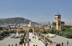
Sakhalin on the map of Russia is far from major cities, and this is a good reason for a sightseeing route. Yuzhno-Sakhalinsk has interesting places to visit, as they are located in the central part of the city. You can get there by city buses.
Sports and Tourist Complex "Mountain Air"
From a special platform on Mount Bolshevik you can see the city and the hills surrounding it. You can walk or climb with the cable car.  It operates all year round, its beginning is on Victory Square. At night, the complex shines with lights.
bear museum
The museum contains exhibits that characterize the life and culture of the XVIII-XXI centuries. Numerous toys in the form of bears, as well as products of well-known Russian creative centers, attract attention.
For visitors there are workshops of various kinds, a garden with live butterflies, a planetarium. The museum is located on the 6th floor of City Mall. You can get there by bus from any part of the city, including the airport and railway station.
Memorial to the soldiers who died during the fighting in 1945 on the territory of Sakhalin and the Kuril Islands. This is a vast complex with military equipment, sculptures, busts of Heroes of the USSR.  The dead are named on the wall of memory. The Eternal Flame burns in their honor. In 2018, the guns and tanks of the memorial, which were damaged by bad weather, were restored. The complex is located on Glory Square, in the city center.
Sakhalin Regional Museum of Local Lore
Located on Communist Avenue in the building of the former Japanese Museum. A park with a fountain has been laid out on the territory of the museum complex, and interesting exhibits have been installed. Free admission. Internal expositions tell about the history and nature, the culture of indigenous peoples, and the modern development of the region. The department of paleontology introduces organisms that inhabited the region millions of years ago.
Sakhalin Zoobotanical Park
Zoobotanical park occupies a vast territory on Detskaya Street. As the name suggests, this is a botanical park with a zoo. Among the plants there are local wild plants, cultivated species, creepers, herbs, mushrooms. 
The zoo contains mammals, birds, it is interesting to visit the exatarium. In the petting zoo you can touch the animals. In the zoo there is an opportunity to see representatives listed in the Red Book.
Chekhov Peak
The Susunay mountains are not very high, only 2 peaks rise above 1 thousand meters. These are the peaks of Pushkin and Chekhov. The height of Chekhov Peak is 1045 m, Pushkin Peak is slightly higher. Chekhov Peak is located near Yuzhno-Sakhalinsk. The ascent is not the most difficult, but appropriate footwear is required. You can climb to the top along the path, where dangerous areas are marked, ropes are stretched, some stones are painted.
In some places there are plants and birds from the Red Book. Although for many citizens this is a favorite vacation spot, there are areas of untouched landscapes preserved here. During the Japanese occupation of the island, a small temple was built on the highest platform, the remains of which are still visible.
When climbing to the top, you can get acquainted with plants typical of Sakhalin: cedar elfin and Kuril bamboo, rhododendrons and dwarf birches. A beautiful panorama opens from the top - hills, lakes, bays and Yuzhno-Sakhalinsk. From the city to the foot is easy to reach by car or on foot from the park named after Yuri Gagarin. You can purchase a tour for 10 hours - from 9 a.m. to 7 p.m.
Cape Giant
The natural monument Cape Velikan is a huge remnant of dense rock, turned by the wind over many thousands of years. But he is not the only one here, the entire coast to Cape Bird looks like a museum of bizarre stone figures. Almost to the water itself, a forested area descends. Tourists can see bird colonies, seal rookeries, pink salmon spawning in summer. 
Fans of car trips should not rush to the shore in early spring, as part of the path runs along the coastline. A bulldozer makes the track more convenient, which clears it at the start of the tourist season. If you wish, you can join the tour, which lasts 10 hours and starts in Yuzhno-Sakhalinsk.
Korsakov Sea Trade Port
The small town of Korsakov is located in Aniva Bay. Numerous moorings, port cranes, clean territory speak of the development and importance of the harbor. Here stand up for loading tankers and bulk carriers, small passenger ships and container ships.
Suitable for the piers and cruise liners. The port provides a link between the island and the Kuril Islands and Japan. To see the panorama of the city and the port, you can go up to the observation deck. The road to Korsakov does not take much time: about 1 hour by regular bus or train, less than 1 hour by car on the highway.
The main lighthouse in Kholmsk
The small port city of Kholmsk is located on the southwestern coast of Sakhalin. There are 5 lighthouses in the city, some of them are Japanese, some are Soviet. The main lighthouse began operating in 1958. 
It is a striped tower made of reinforced concrete, rising above sea level by 67 m, although its height is 29 m. The lighthouse performs 2 tasks - it acts as a light and radio beacon. The light signal turns on every night, regardless of the time of year.
A regular bus departs from Yuzhno-Sakhalinsk to Kholmsk every hour. By car, you can drive along the highway in 1.5-2 hours. A dirt road has been laid from the city to the lighthouse, but in winter it is not cleared.
Yacht club "Vodnik" in the city of Kholmsk
The yacht club on Sovetskaya Street has existed since 1969 and unites children and adults who love sailboats. Members of the club participate in competitions, go on sailing trips. The guys can get professional training to work on yachts of different types.
quiet bay
In Quiet Bay, only seagulls and waves crashing on the shore make noise. From the wind, the bay is closed by rocks turned by the wind. You can walk along the coast, look into the grottoes. Fishing, the underwater world, the beauty of coastal plants also attract lovers. Fans of walking in the mountains can climb the Zhdanko ridge, look into the distance, at the sea, and take interesting photos. 
Tikhaya Bay got its name from Ivan Kruzenshtern, a famous Russian navigator, but in winter strong winds and blizzards rage here. Therefore, a visit to the bay in winter may appeal only to professional climbers and athletes. You can get here by car or by train from Yuzhno-Sakhalinsk railway station. The journey by train will take no more than 3 hours, the further journey is on foot.
Moneron Island
The island is located near the southwestern coast of Sakhalin and is a national natural marine park. This is a specially protected area with the possibility of educational tourism, so before the trip you need to get acquainted with the rules for visitors.
This is a small island, towering 440 m above the sea, an ancient, already collapsed volcano. The main advantage of the protected area is the unique combination of landscapes in a small area. The relative inaccessibility for most tourists facilitates the tasks of the park staff.
Picturesque mountains, alpine meadows, gorges with steep walls, waterfalls, stone sculptures, small caves - all this can be seen on Moneron. A trail made of boards has been laid especially for tourists, there are houses for visitors to the island, and routes to the main attractions have been developed.
Around the island in summer the sea is warm, the water is clear, so underwater shooting here is especially successful. Of particular interest is the unique sea lion rookery, to which a special route has been laid.
They get here only by boat from the port of Nevelsk, which is not always possible due to the weather. For reliability, you can buy a tour for 2 days from Yuzhno-Sakhalinsk. Then you will not need to worry about transport and excursions.
Rocks "Three brothers"
In order to get to the rocks, you need to take a train in Yuzhno-Sakhalinsk, get to the Tymovskoye station, transfer there by bus and get to the first capital of Sakhalin, Aleksandrovsk-Sakhalinsky. 
Further - by taxi or on foot along the coast. Having decided to move around the island in a private car, you need to follow the highway. The final destination of the route is Cape Zhonkier. It is here that the natural monument "Three Brothers" is located. These are three rocks, similar to each other, but different in size. Like brothers - older, middle, younger. The picturesque group is placed on the coat of arms and the flag of the city.
Fossil lovers can add to their collections samples of coal, ancient shells and plants.
A lighthouse is visible on the shore, which has existed since the end of the 19th century, now dilapidated. Another interesting object is the tunnel through the rock, built at the same time, for the horse-drawn railway.
It was never used, as it was flooded at high tide, but you can still walk on it. At the exit from the tunnel, another group of three rocks is visible - "Three Sisters". They are smaller and less showy than the "brothers".
thermal springs
There are many thermal springs on Sakhalin, as the island is located in the zone of active volcanoes. However, only 2 groups of all are used.

Supporters of organized treatment can purchase a ticket to the Dagi-Oasis sanatorium complex in the small village of Goryachiye Klyuchi. Those who are accustomed to life in hotels will be satisfied with a hotel room in the village of Nogliki. People get here by train from Yuzhno-Sakhalinsk, then by car along an asphalt road.
- Not far from Yuzhno-Sakhalinsk are Sinegorsk springs. Their composition is unique, as they contain arsenic. The sanatorium has a staff of highly qualified specialists to assist vacationers. The sanatorium is located in the village of Sanatornoye, easily accessible by bus or car from Yuzhno-Sakhalinsk.
Ski resorts
In winter, the capital of the island offers the following options for vacationers:

It is important for tourists to decide in advance on the timing of trips. Although Sakhalin does not look very impressive on the map of winter tourism in Russia, the winter months from the first days of December to the last days of April are suitable for skiers to relax. Sanatoriums operate regardless of the season. Sightseeing is better to postpone for the summer.
Article formatting: Mila Fridan
Video about Sakhalin
What is life like on Sakhalin Island:
Sakhalin Island from the satellite
Sakhalin has not always been separated from the mainland. At the dawn of civilization, the water level in the world's oceans steadily decreased, as a result of which so-called "bridges" arose in the strait. Presumably, it was along them that the first people moved here (about 300 thousand years ago). In the Middle Ages, the main inhabitants of Sakhalin were the Nivkhs and Ainu - small peoples who constantly migrated between the island and the Asian part of the mainland. Later, Tungus-speaking tribes were added to them. The very name "Sakhalin" appeared due to a geographical error. Due to an oversight, the Manchu name of the Amur River - Sakhalyan-Ulla - was correlated with the territory of the island. By the way, the literal translation of the word is “Rocks of the Black River”.
Until about the 50s of the 19th century, China ruled Sakhalin Island. At the same time, officially the territory did not belong to the Celestial Empire. In 1855, the governments of Japan and Russia signed the Treaty of Shimoda, according to which both states declared Sakhalin joint possession. However, after 20 years, Russia annexed the island, paying for it with Japan with the northern Kuriles. However, the joy of expanding possessions was short-lived. After losing in the Russian-Japanese campaign, the southern part of the island again went to the Land of the Rising Sun. It was possible to finally decide the fate of Sakhalin only after the Second World War, when Russia completely regained the island, and with it the previously lost Kuriles.

Economy and population

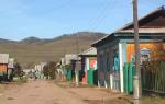
A little less than 500 thousand people live on Sakhalin, about 200 thousand of which are residents of the regional center, Yuzhno-Sakhalinsk. The vast majority of the population is Russian, although among the local inhabitants you can meet both Koreans and people from the former Soviet republics. But there are very few representatives of indigenous peoples here: only 1% of the total.
The economy of the region is unevenly developed, which is why the standard of living of the population in different parts of Sakhalin differs. For example, the northern part of the island, including Yuzhno-Sakhalinsk, exists due to oil production, while the remote and western regions, where production stopped during the collapse of the Soviet Union, are literally forced to struggle for existence. Ultimately, unemployment and a low standard of living led to the fact that most of the inhabitants of the Sakhalin periphery turned to poachers. Illegal shooting of wild animals, extraction of red caviar by barbaric methods are slowly but surely causing irreparable damage to the nature of the great island...
Climate and nature
Going on a trip to Sakhalin, it is better to prepare in advance for weather surprises. Since the climate of the island is temperate monsoon, the weather here is not stable. Local snowy and frosty winters are actively "helped" by atmospheric whirlwinds, bringing strong snowstorms with them. Spring here is long and cold, but summer is relatively warm, but short and often rainy. Another weather problem on Sakhalin is frequent and unpredictable cyclones, bringing with them devastating typhoons and floods.


Sakhalin is an island with a unique ecosystem that was formed in a certain isolation. The terrain is formed by small mountains, low mountains and, to a lesser extent, low-lying plains, while 2/3 of the territory is occupied by taiga. By the way, there is no shortage of fresh water on Sakhalin: 17 rivers and over 16 thousand lakes provide abundant life-giving moisture for the flora and fauna of the island. Despite the fact that the flora and fauna of Sakhalin is somewhat poorer compared to the mainland or the nearest Japanese island of Hokkaido, it has something to surprise wildlife lovers. About 136 species of animals and almost 133 species of local plants are listed in the Red Book. In addition, here you can meet endemic (growing or living only in a specific place) representatives of the animal and plant world.

Sakhalin has become a true paradise for fans of fishing and hunting. The abundance of fish and game in local forests and reservoirs is difficult to describe in words. The Sakhalin taiga is also rich in mushrooms and berries. To collect a tasty "tribute", it is not necessary to delve into the impenetrable jungle. Lingonberries, blueberries, cranberries, redberries can be found here almost under every bush. However, it is not entirely reasonable to go to the other side of the country solely for the gifts of the forest, especially since the natural resources of the island are not limited to berries and fishing spots. There are also thermal springs, bathing in which can relieve chronic diseases, and fabulous caves filled with stalactite crystals, and sites of ancient people. True, it is worth noting that most of the local entertainment is suitable for those who are easy-going and ready to show at least minimal physical activity. Rafting, windsurfing, skiing and snowboarding, kayaking, climbing and paragliding, descending into mountain caves and unforgettable bike rides - this is not a complete list of activities that Sakhalin is ready to offer to supporters of an active lifestyle.

Sights of Sakhalin

The main and most valuable attraction of Sakhalin is its amazing nature. It is customary to come here not for high-quality European service and glossy sights, but for a delightful atmosphere of complete unity with nature, active recreation and an amazing feeling of complete freedom.
reserves
The most convenient and correct way to get acquainted with the wildlife of Sakhalin Island is local reserves, the most interesting of which is the Vostochny State Nature Reserve. You can get here only with a special permit issued by the Department of Forests, but the red tape with a pass is more than paid off by the impressions of the visit. It is here that you can meet such a rare phenomenon for the island as dark coniferous taiga, see how pink salmon, chum salmon and coho salmon spawn and take pictures of clumsy sea lions resting on coastal rocks. To get acquainted with the Sakhalin wild grouse and reindeer, it is better to go to the "Nogliksky" reserve. In autumn, reindeer races are held here, so if your visit to the island coincided with the autumn season, do not miss the opportunity to visit this unusual event. Well, the most interesting thing to watch bird "bazaars" is in the Poronaisky nature reserve, which occupies the eastern part of Sakhalin and the Patience Peninsula.


Volcanoes
Infernal vents filled with lava splashing in all directions are not about Sakhalin volcanoes. Here, craters spew out… land mixed with water. The Pugachevsky and Yuzhno-Sakhalinsk mud volcanoes even look non-trivial. Regular circles, devoid of vegetation and dotted with miniature "pores" of craters, resemble space landscapes from a fantastic blockbuster. By the way, the last major ejection from the Yuzhno-Sakhalinsk volcano occurred in 2011, as a result of which a new mud field formed in its vicinity.
thermal springs

Sakhalin nature not only pleases the eye, but also heals the body. If you find yourself on the island, be sure to swim in the Sinegorsk mineral springs, because water with such a unique composition is found only on Sakhalin and Adler. Today, there are 4 mineral wells in the Sinegorskoye deposit, the water from which is used for drinking, as well as for the treatment of diseases of the cardiovascular and musculoskeletal systems.
In the northeast of Sakhalin Island, in the Nogliki district, there is another unusual place - the Dagin thermal springs, which are funnel-shaped depressions in silty soil. Healing water with a high content of alkali, as well as silicic acid and a temperature of up to +40 ... +45 ° C, helps in the treatment of infertility and joint diseases. Once on the adjacent territory there was a balneary, but then the place gradually fell into disrepair. Today, only a modest dressing house reminds of the former glory of the natural resort. However, this did not make the springs less healing, and the place is still popular with both the local population and tourists.
lakes
One of the largest lakes on Sakhalin Island is Tunaicha. Located in the vicinity of the village of Okhotskoye, this beautiful reservoir is famous for the fact that about 29 species of fish live in it. In addition, it is in Tunaichu that the Sakhalin salmon comes to spawn. Officially, industrial fishing is prohibited here, but from August to September, amateurs are allowed to sit on the shores of the lake with a fishing rod.
Those who like more secluded places should book a tour to the South Reed Range, where the fabulous lakes of Mount Spamberg are lost on a picturesque plateau. 18 of the purest reservoirs, born as a result of rock falls, have their own, partially isolated ecosystem. The plateau area is also known for the fact that numerous springs and waterfalls of the Sakhalin region originate from here. Here you can also find the main waterfall of the island - Shuisky.

caves

Sakhalin is one of the most successful places for beginner speleologists. Acquaintance with local caves should be started from Mount Wajda. Fantastic multi-level dungeons, decorated with bizarre sinter formations, abound here. The intricate network of wells, underground passages and halls of Vaida has been assigned an average level of difficulty, so during the caving tour you will hardly have to complain about the mediocrity and monotony of the excursion. A trip to the cave of "Bear Tragedies" will bring no less impressions. The gloomy stone hall, which has become a kind of cemetery of bear remains, will remain in your memory for a long time. Once upon a time, during archaeological excavations, objects of an ancient cult, as well as tools of labor of the first people, were found here.
Moneron Island is located 43 km from Sakhalin, in the Tatar Strait. Today these lands are empty, although the first settlers appeared here in the first millennium BC. For some time, the island belonged to the Japanese, who seriously deteriorated its ecology, destroying most of the coniferous forests. A reminder of this era is the lighthouse, which remained here in memory of the Japanese colonization. Today Moneron has the status of a natural park and is actively visited by travelers. About 37 species of plants listed in the Red Book grow on the island, but Moneron is better known among tourists as a place of bird "bazaars", as well as rookeries of sea lions and seals.
Hunters and fishermen

At the disposal of tourists who come to Sakhalin to sit with a fishing rod and shoot local game, there are several recreation centers at once. As a rule, these are hotel-type houses, located in especially picturesque and at the same time inaccessible places on the island. You often have to use special equipment to get to them, but for real adventurers this is by no means an obstacle. "Upper", "Moguchi", "Lower" - each of the bases offers a similar range of services, including fishing, hunting, a Russian bath and other "brutal" pleasures. You can also get hold of hunting trophies in special farms. For example, the hunting tribal economy "Geeva" in the village. Nogliki invites his guests to "go" for a bear or an elk. 50 km from Yuzhno-Sakhalinsk is the Okhotsk farm, where anyone can shoot at hares and ducks, as well as try to catch chum salmon, pink salmon or taimen.
Skiers
On the outskirts of Yuzhno-Sakhalinsk, the main ski slope of the island is located - the tourist complex "Mountain Air". You can relax here with the whole family and at any time of the year, however, the base gathers the maximum number of guests during the winter months. Skiing, snowboarding, tubing - for each sport there is its own type of equipped trails with a total length of about 10 km. On the territory of the complex there is a rental of sports equipment, in addition, all the slopes of the camp site are equipped with special lifts. In the summer it is customary to come here to paraglide or rent a bike to explore the surroundings.
Remnant Frog on Sakhalin IslandMineral springs, volcanoes, ski slopes - all this is certainly interesting, but not entirely original. If you are one of those who crave unusual sights, welcome to the Krasnogorsk yew forest. Such a green massif, entirely consisting of century-old yews, is not found in any other corner of the planet. You can get a lot of positive emotions and as many spectacular photos on Tyuleniy Island, where the largest rookery of marine mammals is located. Fans of anomalous places, covered with mystical legends, should look into the remnant of the Frog. Well, you can taste the delicious gifts of Sakhalin nature at Uspenovskie cranberries. A vast treeless space, completely covered with a berry carpet, will appear in your dreams for a long time to come.

Museums
Despite the fact that Sakhalin is considered to be the land of nature tourism, some cultural entertainment is also available here. Art connoisseurs will be interested in visiting the exposition of the art museum, which is located on Lenin Street in Yuzhno-Sakhalinsk. You can get acquainted with the history, as well as the flora and fauna of the island in the local history museum, located in a colorful Japanese house on Communist Avenue. If you are traveling with children, be sure to take the time to visit the zoobotanical park, where you can see rare and endangered species of local animals. An interesting and informative excursion is offered to its guests by the Museum of the History of the Sakhalin Railway, which contains the rarest examples of railway equipment.
How to get there

You can get to Sakhalin relatively quickly and comfortably by plane. The Russian company Aeroflot operates several direct flights from Moscow to Yuzhno-Sakhalinsk. A standard flight usually takes from 8 to 9 hours. An option for those who are not looking for an easy way is the Vanino-Kholmsk ferry crossing. To get to the port of Vanino (Khabarovsk Territory), you must pre-purchase a train ticket on the route: Moscow-Khabarovsk or Moscow-Vladivostok (the trip lasts from 5 to 6 days). It is better to get from the Khabarovsk railway station to Vanino by taxi. The final stage of the journey is boarding the ferry and a 14-hour voyage through the Tatarsky Strait.

Sakhalin island
Sakhalin- an island off the east coast of Asia. It is part of the Sakhalin Oblast, the largest island in the Russian Federation. It is washed by the Sea of Okhotsk and the Sea of Japan. It is separated from mainland Asia by the Tatar Strait (in the narrowest part, the Nevelskoy Strait, it is 7.3 km wide and freezes in winter); from the Japanese island of Hokkaido - by the La Perouse Strait.
The island got its name from the Manchu name of the Amur River - "Sakhalyan-ulla", which means "Black River" - this name, printed on the map, was mistakenly attributed to Sakhalin, and in further editions of the maps it was already printed as the name of the island. The Japanese call Sakhalin Karafuto, this name goes back to the Ainu "kamuy- kara-puto-ya-mosir", which means "the land of the god of the mouth".
In 1805, a Russian ship under the command of I.F. Kruzenshtern explored most of the coast of Sakhalin and concluded that Sakhalin is a peninsula. In 1808, Japanese expeditions led by Matsuda Denjuro and Mamiya Rinzo proved that Sakhalin was an island. Most European cartographers were skeptical of the Japanese data. For a long time, on various maps, Sakhalin was designated either as an island or a peninsula. Only in 1849 did the expedition under the command of G. I. Nevelsky put an end to this issue, passing on the military transport ship Baikal between Sakhalin and the mainland. This strait was subsequently named after Nevelskoy.
Geography
The island is elongated meridionally from Cape Crillon in the south to Cape Elizabeth in the north. The length is 948 km, the width is from 26 km (the Poyasok isthmus) to 160 km (at the latitude of the village of Lesogorskoye), the area is 76.4 thousand km².

Map of Sakhalin Island 1885
Relief
The relief of the island is composed of medium-altitude mountains, low mountains and low plains. The southern and central parts of the island are characterized by mountainous relief and consist of two meridionally oriented mountain systems - the West Sakhalin (up to 1327 m high - Onor) and East Sakhalin mountains (up to 1609 m high - Lopatina), separated by the longitudinal Tym- Poronai lowland. The north of the island (with the exception of the Schmidt Peninsula) is a gentle hilly plain.
The shores of the island are slightly indented; large bays - Aniva and Patience (widely open to the south) are located respectively in the southern and middle parts of the island. There are two large bays and four peninsulas in the coastline.
In the relief of Sakhalin, the following 11 regions are distinguished:
- The Schmidt Peninsula (about 1.4 thousand km²) is a mountainous peninsula in the far north of the island with steep, sometimes steep coasts and two meridional ridges - Western and Eastern; the highest point is Mount Three Brothers (623 m); connected to the North Sakhalin Plain by the Okha Isthmus, the width of which at its narrowest point is just over 6 km;
- The North Sakhalin Plain (about 28 thousand km²) is a gently undulating area south of the Schmidt Peninsula with a widely branched river network, weakly expressed watersheds and individual low mountain ranges, stretching from Baikal Bay in the north to the confluence of the Nysh and Tym rivers in the south, the highest point - Daakhuria (601 m); the northeastern coast of the island stands out as a subarea, which is characterized by large lagoons (the largest are Piltun, Chaivo, Nyisky, Nabilsky, Lunsky bays), separated from the sea by narrow strips of alluvial spits, dunes, low sea terraces - it is in this subarea that the main Sakhalin oil and gas fields are located on the adjacent shelf of the Sea of Okhotsk;
- The West Sakhalin Mountains stretch for almost 630 km from the latitude with. Hoe (51º19 "N) in the north to the Crillon Peninsula in the extreme south of the island; the average width of the mountains is 40-50 km, the largest (at the latitude of Cape Lamanon) is about 70 km; the axial part is formed by Kamyshovy (north of the isthmus Belt) and South Kamyshovy ridges;
- The Tym-Poronai lowland is located in the middle part of the island and is a hilly-ridged lowland stretching for about 250 km in the meridional direction - from Terpeniya Bay in the south to the confluence of the Tym and Nysh rivers in the north; reaches its maximum width (up to 90 km) at the mouth of the Poronay River, the minimum (6-8 km) - in the valley of the Tym River; in the north it passes into the Nabil lowland; covered with a thick cover of Cenozoic sediments, composed of sedimentary deposits of the Quaternary period. sandstones, pebbles; the heavily swampy southern part of the lowland is called the Poronai "tundra";
- The Susunai lowland is located in the southern part of the island and stretches for about 100 km from Aniva Bay in the south to the Naiba River in the north; from the west, the lowland is bounded by the West Sakhalin Mountains, from the east - by the Susunai Range and the Korsakov Plateau; in the southern part, the width of the lowland reaches 20 km, in the center - 6 km, in the north - 10 km; absolute heights in the north and south do not exceed 20 m above sea level, in the central part, on the watershed of the Susuya and Bolshoi Takaya river basins, they reach 60 m; refers to the type of internal lowlands and is a tectonic depression filled with a large thickness of Quaternary deposits; within the Susunai lowland are the cities of Yuzhno-Sakhalinsk, Aniva, Dolinsk and about half of the island's population lives;
- The East Sakhalin Mountains are represented in the north by the Lopatinsky mountain junction (the highest point is the city of Lopatina, 1609 m) with ridges extending radially from it; two spurs of the opposite direction represent the Nabil Range; in the south, the Nabilsky Range passes into the Central Range, in the north, sharply lowering, into the North Sakhalin Plain;
- the lowlands of the Patience Peninsula - the smallest of the districts, occupies most of the Patience Peninsula east of Patience Bay;
- The Susunai Range stretches from north to south for 70 km and has a width of 18-120 km; the highest points are Mount Pushkinskaya (1047 m) and Chekhov Peak (1045 m); composed of Paleozoic deposits, at the foot of the western macroslope of the ridge is the city of Yuzhno-Sakhalinsk;
- The Korsakov plateau is bounded from the west by the Susunai lowland, from the north by the Susunaysky ridge, from the east by the Muravyovskaya lowland, from the south by Aniva Bay, has a slightly undulating surface formed by a system of flat-topped ridges elongated in a northeast direction; at the southern end of the plateau on the shores of Aniva Bay is the city of Korsakov;
- The Muravyovskaya lowland is located between Aniva bays in the south and Mordvinov bays in the north, has a ridged relief with flat tops of the ridges; within the lowlands there are many lakes, incl. the so-called "Warm Lakes", where people from South Sakhalin like to go on vacation;
- The Tonino-Aniva Range stretches from north to south, from Cape Svobodny to Cape Aniva, for almost 90 km, the highest point is Mount Kruzenshtern (670 m); composed of Cretaceous and Jurassic deposits.

View of the Sea of Okhotsk from the high shore near the lighthouse in the area of the Warm Lakes
Climate
The climate of Sakhalin is cool, moderately monsoonal (the average temperature in January is from -6ºС in the south to -24ºС in the north, in August - from +19ºС to +10ºС, respectively), maritime with long snowy winters and short cool summers.
The following factors influence the climate:
- Geographical position between 46º and 54º N. latitude. determines the arrival of solar radiation from 410 kJ/year in the north to 450 kJ/year in the south.
- The position between the Eurasian continent and the Pacific Ocean determines the monsoonal nature of the climate. A humid and cool, rather rainy Sakhalin summer is associated with it.
- Mountainous terrain affects the direction and speed of the wind. A decrease in wind speed in intermountain basins (in particular, in the relatively large Tym-Poronai and Susunai lowlands) contributes to cooling the air in winter and heating in summer, it is here that the greatest temperature contrasts are observed; while the mountains protect the named lowlands, as well as the western coast from the effects of the cold air of the Sea of \u200b\u200bOkhotsk.
- In summer, the contrast between the western and eastern coasts of the island is enhanced by the respectively warm Tsushima Current of the Sea of Japan and the cold East Sakhalin Current of the Sea of Okhotsk.
- The cold Sea of Okhotsk affects the climate of the island like a giant thermal accumulator, determining a long cold spring and a relatively warm autumn: snow in Yuzhno-Sakhalinsk sometimes lasts until mid-May, and the flower beds of Yuzhno-Sakhalinsk can bloom until early November. If we compare Sakhalin with similar (in terms of climatic indicators) territories of European Russia, then the seasons on the island succeed each other with a delay of about three weeks.
Air temperature and precipitation in Yuzhno-Sakhalinsk in the 21st century (temperature: II.2001-IV.2009; precipitation: III.2005-IV.2009):
| Options / Months | I | II | III | IV | V | VI | VII | VIII | IX | X | XI | XII | Year |
|---|---|---|---|---|---|---|---|---|---|---|---|---|---|
| Maximum air temperature, ºС | 1,7 | 4,1 | 9,0 | 22,9 | 25,0 | 28,2 | 29,6 | 32,0 | 26,0 | 22,8 | 15,3 | 5,0 | 32,0 |
| Average air temperature, ºС | −11,6 | −11,7 | −4,6 | 1,8 | 7,4 | 12,3 | 15,5 | 17,3 | 13,4 | 6,6 | −0,8 | −9,0 | 3,2 |
| Minimum air temperature, ºС | −29,5 | −30,5 | −25,0 | −14,5 | −4,7 | 1,2 | 3,0 | 4,2 | −2,1 | −8,0 | −16,5 | −26,0 | −30,5 |
| The amount of precipitation, mm | 49 | 66 | 62 | 54 | 71 | 38 | 37 | 104 | 88 | 96 | 77 | 79 | 792 |
The maximum temperature on Sakhalin (+39ºС) was noted in July 1977 in the village. Border on the east coast (Nogliki district). The minimum temperature on Sakhalin (-50ºС) was recorded in January 1980 in the village. Ado-Tymovo (Tymovsky district). The registered temperature minimum in Yuzhno-Sakhalinsk is -36ºС (January 1961), maximum - +34.7ºС (August 1999).
The highest average annual precipitation (990 mm) falls in the city of Aniva, the smallest (476 mm) - at the Kuegda meteorological station (Okhinsky district). The average annual amount of precipitation in Yuzhno-Sakhalinsk (according to long-term data) is 753 mm.
The earliest stable snow cover appears on Cape Elizaveta (Okhinsky district) and in the village of Ado-Tymovo (Tymovsky district) - on average October 31, the latest - in Korsakov (on average December 1). The average dates of snow cover melting are from April 22 (Kholmsk) to May 28 (Cape Elizabeth). In Yuzhno-Sakhalinsk, stable snow cover appears on average on November 22 and disappears on April 29.
The most powerful typhoon in the last 100 years (“Phyllis”) hit the island in August 1981. The maximum precipitation then occurred on August 5-6, and in total from August 4 to 7, 322 mm of precipitation fell in the south of Sakhalin (about three monthly norms) .
Inland waters
The largest rivers of Sakhalin:
| River | Administrative region(s) | Where does it flow | Length, km | Basin area, km² | Average annual runoff, km³ |
|---|---|---|---|---|---|
| Poronai | Tymovsky, Smirnykhovsky, Poronaysky | Gulf of Patience, Sea of Okhotsk | 350 | 7990 | 2,49 |
| Tym | Tymovsky, Nogliksky | Nyisky Bay of the Sea of Okhotsk | 330 | 7850 | 1,68 |
| Naiba | Dolinsky | Gulf of Patience, Sea of Okhotsk | 119 | 1660 | 0,65 |
| Lutoga | Kholmsky, Anivsky | Aniva Bay of the Sea of Okhotsk | 130 | 1530 | 1,00 |
| Shaft | Nogliki | Chayvo Bay of the Sea of Okhotsk | 112 | 1440 | 0,73 |
| Ainu | Tomarinsky | lake Ainu | 79 | 1330 | ... |
| Nysh | Nogliki | Tym river (left tributary) | 116 | 1260 | ... |
| Charcoal (Esutoru) | Uglegorsky | Sea of Japan (Tatar Strait) | 102 | 1250 | 0,57 |
| Langeri (Langry) | Okhinsky | Amur Estuary of the Sea of Okhotsk | 130 | 1190 | ... |
| Big | Okhinsky | Sakhalin Bay of the Sea of Okhotsk | 97 | 1160 | ... |
| Rukutama (Vitnica) | Poronai | lake Nevsky | 120 | 1100 | ... |
| reindeer | Poronai | Gulf of Patience, Sea of Okhotsk | 85 | 1080 | ... |
| Lesogorka (Taimyr) | Uglegorsky | Sea of Japan (Tatar Strait) | 72 | 1020 | 0,62 |
| Nabil | Nogliki | Nabil Bay of the Sea of Okhotsk | 101 | 1010 | ... |
| Malaya Tym | Tymovsky | Tym river (left tributary) | 66 | 917 | ... |
| Leonidovka | Poronai | Poronay river (right tributary) | 95 | 850 | 0,39 |
| Susuya | Yuzhno-Sakhalinsk, Anivsky | Aniva Bay of the Sea of Okhotsk | 83 | 823 | 0,08 |
There are 16120 lakes on Sakhalin with a total area of about 1000 km². The areas of their greatest concentration are the north and southeast of the island. The two largest lakes of Sakhalin are Nevsky with a mirror area of 178 km² (Poronaisky district, near the mouth of the Poronai River) and Tunaicha (174 km²) (Korsakovsky district, in the north of the Muravyovskaya lowland); both lakes belong to the lagoon type.
Natural resources
Sakhalin is characterized by a very high potential of natural resources. In addition to biological resources, in terms of reserves of which Sakhalin is one of the first places in Russia, hydrocarbon reserves are very large on the island and its shelf. In terms of explored reserves of gas condensate, the Sakhalin Region ranks 4th in Russia, gas - 7th, coal - 12th and oil - 13th, while within the region, the reserves of these minerals are almost entirely concentrated in Sakhalin and his shelf. Other natural resources of the island include timber, gold, platinum.
Flora and fauna
Both the flora and fauna of the island are depleted both in comparison with the adjacent areas of the mainland, and in comparison with the island of Hokkaido located to the south.
Flora
As of the beginning of 2004, the flora of the island includes 1521 species of vascular plants belonging to 575 genera from 132 families, with 7 families and 101 genera represented only by invasive species. The total number of alien species on the island is 288, or 18.9% of the composition of the entire flora. According to the main systematic groups, vascular plants of the Sakhalin flora are distributed as follows (excluding adventitious ones): vascular spores - 79 species (including lycopods - 14, horsetails - 8, ferns - 57), gymnosperms - 9 species, angiosperms - 1146 species ( including monocots - 383, dicots - 763). The leading families of vascular plants in the flora of Sakhalin are sedge ( Cyperaceae) (121 species excluding aliens - 122 species including aliens), Compositae ( Asteraceae) (120 - 175), cereals ( Poaceae) (108 - 152), rosaceous ( Rosaceae) (58 - 68), ranunculus ( Ranunculaceae) (54 - 57), heather ( Ericaceae) (39 - 39), clove ( Caryophyllaceae) (38 - 54), buckwheat ( Polygonaceae) (37 - 57), orchids ( Orchidaceae) (35 - 35), cruciferous ( Brassicaceae) (33 - 53).
Fauna

Pink salmon goes to spawn in a nameless river that flows into Mordvinov Bay
"Red Book"
The fauna, flora and mycobiota of the island include many rare protected species of animals, plants and fungi. 12 mammal species recorded on Sakhalin, 97 bird species (including 50 nesting species), seven fish species, 20 invertebrate species, 113 vascular plant species, 13 bryophyte species, seven algae species, 14 fungi species and 20 lichen species (t ie 136 species of animals, 133 species of plants and 34 species of fungi - a total of 303 species) have protected status, i.e. are listed in the "Red Book of the Sakhalin Region", while about a third of them are simultaneously included in the "Red Book of the Russian Federation".
Of the "federal Red Book" flowering plants, the flora of Sakhalin includes Aralia heart-shaped ( Aralia cordata), calypso bulbous ( Calypso bulbosa), Glen's cardiocrinum ( Cardiocrinum glehnii), Japanese sedge ( carex japonica) and lead gray ( C.livida), lady's slippers real ( Cypripedium calceolus) and large-flowered ( C. macranthum), Gray's double leaf ( Diphylleia grayi), leafless chin ( Epipogium aphyllum), Japanese kandyk ( Erythronium japonicum), high paunch ( Gastrodia elata), iris xiphoid ( Iris ensata), walnut ailantolium ( Juglans ailanthifolia), calopanax seven-lobed ( Kalopanax septemlobum), tiger lily ( lilium lancifolium), Tolmachev's honeysuckle ( Lonicera tolmatchevii), long-legged winged seed ( macropodium pterospermum), miyakiya whole-leaved ( Miyakea integrifolia) (miyakia is the only endemic genus of vascular plants on Sakhalin), nest flower ( Neottianthe cucullata), peonies obovate ( Paeonia obovata) and mountainous ( P. oreogeton), bluegrass rough ( Poa radula) and Viburnum Wright ( Viburnum wrightii), i.e. 23 types. In addition, eight more "federal Red Book" plants are found on the island: two types of gymnosperms - Sargent's juniper ( Juniperus sargentii) and yew spiky ( taxus cuspidata), three species of ferns - Asiatic half-grass ( Isotes asiatica), Mikel's leptorumora ( Leptorumohra miqueliana) and Wright's mecodium ( Mecodium wrightii), two species and one variety of mosses - Japanese bryoxiphium ( Bryoxiphium norvegicum var. japonicum), northern necker ( Neckera borealis), and plagiothecium obtuse ( Plagiothecium obtusissimum).
Population
According to the results of the 2002 census, the population of the island was 527.1 thousand people, incl. 253.5 thousand men and 273.6 thousand women; about 85% of the population are Russians, the rest are Ukrainians, Koreans, Belarusians, Tatars, Chuvashs, Mordovians, several thousand people each of representatives of the indigenous peoples of the North - Nivkhs and Oroks. From 2002 to 2008 the population of Sakhalin continued to slowly (by about 1% per year) decline: mortality still prevails over births, and attracting labor from the mainland and from countries neighboring Russia does not compensate for the departure of Sakhalin residents to the mainland. At the beginning of 2008, about 500 thousand people lived on the island.
The largest city of the island is the regional center Yuzhno-Sakhalinsk (173.2 thousand people; 01/01/2007), other relatively large cities are Korsakov (35.1 thousand people), Kholmsk (32.3 thousand people), Okha (26.7 thousand people), Nevelsk (17.0 thousand people), Poronaysk (16.9 thousand people).
The population is distributed among the regions of the island as follows (results of the 2002 census, people):
| District | All population | %% of total | Urban population | Rural population |
|---|---|---|---|---|
| Yuzhno-Sakhalinsk and subordinate settlements | 182142 | 34,6 | 177272 | 4870 |
| Aleksandrovsk-Sakhalinsky | 17509 | 3,3 | 14764 | 2746 |
| Anivsky | 15275 | 2,9 | 8098 | 7177 |
| Dolinsky | 28268 | 5,4 | 23532 | 4736 |
| Korsakovsky | 45347 | 8,6 | 39311 | 6036 |
| Makarovsky | 9802 | 1,9 | 7282 | 2520 |
| Nevelsky | 26873 | 5,1 | 25954 | 921 |
| Nogliki | 13594 | 2,6 | 11653 | 1941 |
| Okhinsky | 33533 | 6,4 | 30977 | 2556 |
| Poronai | 28859 | 5,5 | 27531 | 1508 |
| Smirnykhovsky | 15044 | 2,9 | 7551 | 7493 |
| Tomarinsky | 11669 | 2,2 | 9845 | 1824 |
| Tymovsky | 19109 | 3,6 | 8542 | 10567 |
| Uglegorsky | 30208 | 5,7 | 26406 | 3802 |
| Kholmsky | 49848 | 9,5 | 44874 | 4974 |
| Sakhalin as a whole | 527080 | 100 | 463410 | 63670 |
Story
Archaeological finds indicate that people appeared on Sakhalin in the Paleolithic, about 20-25 thousand years ago, when, as a result of glaciation, the level of the World Ocean dropped and land "bridges" were restored between Sakhalin and the mainland, as well as Sakhalin and Hokkaido. (Then on another land "bridge" between Asia and America, located on the site of the modern Bering Strait, Homo sapiens moved to the Americas). In the Neolithic (2-6 thousand years ago), Sakhalin was inhabited by the ancestors of modern Paleo-Asian peoples - the Nivkhs (in the north of the island) and the Ainu (in the south).
These same ethnic groups made up the main population of the island in the Middle Ages, with the Nivkhs migrating between Sakhalin and the lower Amur, and the Ainu between Sakhalin and Hokkaido. Their material culture was similar in many ways, and their livelihood was provided by fishing, hunting and gathering. At the end of the Middle Ages (in the 16th-17th centuries), Tungus-speaking peoples appeared on Sakhalin - Evenks (nomadic reindeer herders) and Oroks (Uilta), who, under the influence of the Evenks, also began to engage in reindeer herding.
According to the Shimodsky Treaty (1855) between Russia and Japan, Sakhalin was recognized as their joint indivisible possession. Under the St. Petersburg Treaty of 1875, Russia received ownership of the island of Sakhalin, in return transferring to Japan all the northern Kuril Islands. After the defeat of the Russian Empire in the Russo-Japanese War of 1904-05 and the signing of the Treaty of Portsmouth, Japan received South Sakhalin (part of Sakhalin Island south of the 50th parallel). As a result of the victory over Japan during World War II, the entire territory of Sakhalin Island and all the Kuril Islands were included in the Soviet Union (RSFSR). On the territory or part of the territory of about. Sakhalin currently has no claims from either Japan or any other country.
Yuzhno-Sakhalinsk was founded by Russians in 1882 under the name of Vladimirovka. After the victory of the USSR and its allies in World War II, together with the entire island, it passed to the USSR.
And 141° and 145° East. The island stretches from north to south for 850 km. The width of the island is maximum 183 kilometers and minimum 24 km.
The nearest distance from the island to the mainland is near the mouth, between Capes Lazarev and Pogobi. Here between the lands 7 km. The southern end of Sakhalin departs from the coast of the mainland at a distance of about 300 km. If you count in parallel. The smallest width of the La Perouse Strait, which separates Sakhalin from Iesso, is about 40 km. Between Sakhalin and the mainland is located, the continuation of which is, which received in its narrowest part, near the mouth of the Amur River, the name of the Nevelskoy Strait. The width of the strait coincides with its depth. From Cape to Cape Mary, the depths are so insignificant that three famous navigators: La Perouse and Broughton tried to penetrate this strait from to. They came to the conclusion that Sakhalin is a peninsula. Subsequently, the fairway was found by Nevelskoye, but it turned out to be passable only for ships with a draft of no deeper than 23 feet (1 foot = 30.5 cm). To the south of Cape Lazarev, the depths increase rapidly.
The water in the North is warmer than in Okhotsk. Which by its properties approaches the polar seas. The main reason for the low Sea of Okhotsk is the masses of ice that originated in the Gizhiginskaya and Peyzhinskaya bays. The ice stays near the northern end of Sakhalin almost all summer long. These ices are carried by the fast Sakhalin current, washing the northern part of the island and the northern half of its eastern coast, to the latitudes of middle Sakhalin. The influence of low temperatures in the Sea of Okhotsk does not extend to the North Japan Sea, as this is prevented by Sakhalin. In addition, the current from the Amur blocks the access of ice from the Sea of Okhotsk to the Tatar and La Perouse Straits. Through these, only the surface layers of both seas are connected, which does not contribute to the cooling of the Sea of Japan for the reason that the warm Japanese sea approaches it. One branch of the current turns into the Sea of Okhotsk, and the other rises along the western coast of Sakhalin and has a beneficial effect on this part of the island.
The physical properties of the seas surrounding Sakhalin determine the difference in the climates of different parts of the island. Its northern part, coming close to the mainland, is climatically influenced by it. Strong cooling during the winter, when the Nevelskoy Strait freezes completely, causes strong northerly and northwesterly winds on Sakhalin.
Under the influence of winds, winters in the northern part of the island are distinguished by continental severity. Freezing of mercury is a common occurrence here. In summer, in the northern part of the island, blowing from the cold Sea of \u200b\u200bOkhotsk prevails, which greatly lower the temperature in summer. Thus, climatically, Northern and Middle Sakhalin are placed in unfavorable conditions: these parts of the island have severe continental winters and cold seaside summers. Winter in the northern part of the average temperature approaches the winter of the coast in or the southern part of the island. Summer is like the summer of the coast, although the northern end of Sakhalin is approximately at the latitude of Simbirsk. At the mouth of the Tym, on the eastern coast of the island and in Due, almost at the latitude of Saratov, it occurs. The further south from Douai, the milder the climate becomes. It takes on a marine character. The difference in climate between the western shores of the island and the opposite coast of the mainland is growing. The difference lies in the fact that the winter cold on Sakhalin is less significant than at the corresponding latitude of the coast of Eastern Siberia. Winter and summer in the southern part of the island resemble the same seasons of the Arkhangelsk and Olonets regions in terms of average temperature. Despite the fact that the southern end of Sakhalin is at the latitude of Odessa and Astrakhan. In addition to the low temperature of winter and summer, Sakhalin is also distinguished by the fact that spring is much colder than autumn. This happens even inside the island, but especially in its south.
Despite the insignificant width of Sakhalin, there is a big difference in the climate of its eastern and western shores. This is precisely the different influence of the seas washing the island. On the eastern coast, washed by the cold, where even in June there are floating ice, at the latitude of the mouth of the Tym River, the climate is much more severe. Winter and summer are colder here than at the corresponding latitude of the western coast. This is because the influence of the cold Sea of Okhotsk, due to the mountainous nature of the island and the meridional location of the ridges that block the winds, is not transmitted to the western coast.

Sakhalin Island (photo by Vladislav Petrushko)
Throughout Sakhalin it is very significant. Winter is characterized by an abundance of snow, and summer by frequent rains. The thickness reaches two meters. In Kusunnai, up to 150 rainy days are observed during the year, of which 60 are rainy and 90 are snowy. Frequent in summer, more on the east than on the west coast. The surface of Sakhalin is almost entirely mountainous, and only between the ridges are lowlands along which rather large rivers flow. The western coast from the southern tip of Cape Crillon consists of an almost solid stone wall. It rises in places up to 100, 200 feet. There is not a single significant bay here, and there are no islands either. The exception is Monneron Island, which lies near the southern end of Sakhalin. The western coast remains in this way up to Cape Wanda, located opposite the De-Kastri Bay. To the north of this cape stretches a flat sandy shore, stretching along the entire Amur estuary. In the Sea of Okhotsk, near the northern tip of Sakhalin, the coast becomes mountainous again. A similar alternation of steep and flat banks is observed on the eastern coast. This is observed at approximately the same latitudes. There are two bays here: Nyisky and Patience Bay.
In those places where the coast is low, there are many lakes, separated from the sea by low isthmuses and connected to it by channels. These channels, as well as the mouths of large rivers, are the only places where small boats can land on the shore.