Why is the Caspian Sea considered a lake? Caspian Sea. Where is it located, photos, characteristics, area, holiday resorts Area of the Caspian Sea in sq km
The Caspian Sea is the largest enclosed body of water on planet Earth, located on the continent of Eurasia - in the border territory of the states of Russia, Kazakhstan, Turkmenistan, Iran and Azerbaijan. In fact, it is a giant lake left after the disappearance of the ancient Tethys Ocean. Nevertheless, there is every reason to consider it as an independent sea (this is indicated by its salinity, large area and considerable depth, a bottom made of oceanic crust and other signs). In terms of maximum depth, it is the third among closed reservoirs - after lakes Baikal and Tanganyika. In the northern part of the Caspian Sea (a few kilometers from northern shore- parallel to it) runs the geographical border between Europe and Asia.
Toponymy
- Other names: throughout the history of mankind, the Caspian Sea has had about 70 different names. The most famous of them: Khvalynskoye or Khvalisskoye (took place during the Ancient Rus', arose from the name of the people praises, who lived in the Northern Caspian region and traded with the Russians), Girkanskoe or Dzhurdzhanskoe (derived from alternative names for the city of Gorgan, located in Iran), Khazar, Abeskunskoe (after the name of the island and city in the Kura delta - now flooded), Saraiskoe, Derbentskoe, Sikhai .
- Origin of the name: According to one hypothesis, the Caspian Sea received its modern and most ancient name from a tribe of nomadic horse breeders Caspian Sea who lived in 1st millennium BC on the southwest coast.
Morphometry
- Catchment area: 3,626,000 km².
- Mirror area: 371,000 km².
- Coastline length: 7,000 km.
- Volume: 78,200 km³.
- Average depth: 208 m.
- Maximum depth: 1,025 m.
Hydrology
- Availability of permanent flow: no, drainless.
- Tributaries:, Ural, Emba, Atrek, Gorgan, Heraz, Sefidrud, Astarchay, Kura, Pirsagat, Kusarchay, Samur, Rubas, Darvagchay, Ulluchay, Shuraozen, Sulak, Terek, Kuma.
- Bottom: very diverse. At shallow depths, sandy soil with an admixture of shells is common; in deep-sea areas, it is silty. In the coastal strip there may be pebble and rocky places (especially where mountain ranges adjoin the sea). In the estuarine areas, the underwater soil consists of river sediments. The Kara-Bogaz-Gol Bay is notable for the fact that its bottom is a thick layer of mineral salts.
Chemical composition
- Water: salty.
- Salinity: 13 g/l.
- Transparency: 15 m.
Geography

Rice. 1. Map of the Caspian Sea basin.
- Coordinates: 41°59′02″ n. latitude, 51°03′52″ e. d.
- Altitude:-28 m.
- Coastal landscape: due to the fact that the coastline of the Caspian Sea is very long, and it itself is located in different geographical areas— The coastal landscape is diverse. In the northern part of the reservoir, the banks are low, swampy, and in the deltas of large rivers, they are cut by numerous channels. The eastern shores are mostly limestone - desert or semi-desert. Western and southern coast adjacent to mountain ranges. The greatest ruggedness of the coastline is observed in the west, in the area of the Absheron Peninsula, and also in the east, in the area of the Kazakh and Kara-Bogaz-Gol bays.
- Settlements on the banks:
- Russia: Astrakhan, Derbent, Kaspiysk, Makhachkala, Olya.
- Kazakhstan: Aktau, Atyrau, Kuryk, Sogandyk, Bautino.
- Turkmenistan: Ekerem, Karabogaz, Turkmenbashi, Khazar.
- Iran: Astara, Balboser, Bender-Torkemen, Bender-Anzeli, Neka, Chalus.
- Azerbaijan: Alyat, Astara, Baku, Dubendi, Lankaran, Sangachali, Sumgayit.
Interactive map
Ecology
The ecological situation in the Caspian Sea is far from ideal. Almost all large rivers flowing into it are polluted by wastewater from industrial enterprises located upstream. This could not but affect the presence of pollutants in the waters and bottom sediments of the Caspian Sea - over the past half century, their concentration has increased significantly, and the content of some heavy metals has already exceeded permissible standards.
In addition, the waters of the Caspian Sea are constantly polluted by domestic wastewater from coastal cities, as well as during oil production on the continental shelf, and during its transportation.
Fishing on the Caspian Sea
- Types of fish:
- Artificial settlement: not all of the above fish species in the Caspian Sea are native. About 4 dozen species arrived by accident (for example, through canals from the basins of the Black and Baltic Seas), or were intentionally populated by humans. As an example, it is worth citing mullets. Three Black Sea species of these fish - mullet, sharpnose and singil - were released in the first half of the 20th century. The mullet did not take root, but the sharpnose and the singil successfully acclimatized, and by now have settled virtually throughout the entire Caspian waters, forming several commercial herds. At the same time, the fish fatten up faster than in the Black Sea and reach larger sizes. In the second half of the last century (starting from 1962), attempts were also made to introduce such Far Eastern salmon fish as pink salmon and chum salmon into the Caspian Sea. In total, several billion fry of these fish were released into the sea over the course of 5 years. Pink salmon did not survive in the new habitat, chum salmon, on the contrary, successfully took root and even began to enter the rivers flowing into the sea to spawn. However, it was unable to reproduce in sufficient quantities and gradually disappeared. There are still no favorable conditions for its full natural reproduction (there are very few places where spawning and development of fry could successfully occur). To provide them, river reclamation is necessary, otherwise, without human help (artificial collection of eggs and their incubation), the fish will not be able to maintain their numbers.


Fishing spots
In fact, fishing is possible anywhere on the Caspian Sea coast, which can be reached by land or water. What types of fish will be caught depends on local conditions, but to a greater extent on whether the rivers flow here. As a rule, in places where estuaries and deltas are located (especially large watercourses), the water in the sea is greatly desalinated, so freshwater fish (carp, catfish, bream, etc.) usually predominate in the catches; species characteristic of the flowing rivers may also be found. rivers (usachi, shemaya). Of the marine species in desalinated areas, those for which salinity does not matter (mullet, some gobies) are caught. At certain periods of the year, semi-anadromous and anadromous species can be found here, feeding in the sea and entering rivers to spawn (sturgeon, some herrings, Caspian salmon). In places where there are no flowing rivers, freshwater species are found in slightly smaller numbers, but marine fish also appear, usually avoiding desalinated areas (for example, sea pike perch). Away from the coast, fish that prefer salt water and deep-sea species are caught.
Conventionally, we can distinguish 9 places or areas that are interesting in terms of fishing:
- North Shore (RF)- this site is located on the northern coast of the Russian Federation (from the Volga delta to the Kizlyar Bay). Its main features are low salinity of water (the lowest in the Caspian Sea), shallow depth, the presence of multiple shoals, islands, and highly developed aquatic vegetation. In addition to the Volga delta with its numerous channels, bays and eriks, it also includes the estuary coastal area, called the Caspian Peaks. These places are popular among Russian fishermen, and for good reason: the conditions for fish here are very favorable, and there is also a good food supply. The ichthyofauna in these parts may not shine with a wealth of species, but it is distinguished by its abundance, and some of its representatives reach quite considerable sizes. Typically, the bulk of the catches are freshwater fish characteristic of the Volga basin. Most often caught: perch, pike perch, roach (more precisely, its varieties called roach and ram), rudd, asp, sabrefish, bream, silver carp, carp, catfish, pike. Somewhat less common are black bream, silver bream, white-eye, and bluegill. Representatives of sturgeons (sturgeon, stellate sturgeon, beluga, etc.) and salmonids (nelma, brown trout - Caspian salmon) are also found in these places, but their fishing is prohibited.
- Northwestern coast (RF)- this area covers the west coast Russian Federation(from Kizlyar Bay to Makhachkala). The rivers Kuma, Terek and Sulak flow here - they carry their waters both through natural channels and artificial canals. There are bays in this area, some of which are quite large (Kizlyarsky, Agrakhansky). The sea in these places is shallow. Freshwater fish predominate in the catches: pike, perch, carp, catfish, rudd, bream, barbel, etc., and marine species are also caught here, for example, herring (blackback, bellyfish).
- West Bank (RF)- from Makhachkala to the border of the Russian Federation with Azerbaijan. An area where mountain ranges adjoin the sea. The salinity of the water here is slightly higher than in previous places, so marine species are more common in fishermen's catches (sea pike perch, mullet, herring). However, freshwater fish are by no means uncommon.
- West Bank (Azerbaijan)- from the border of the Russian Federation with Azerbaijan along the Absheron Peninsula. Continuation of the area where mountain ranges adjoin the sea. Fishing here is even more similar to typical offshore fishing, with fish such as razorback and mullet and several species of gobies also caught here. In addition to them, there are kutum, herring, and some typically freshwater species, for example, carp.
- Southwestern coast (Azerbaijan)- from the Absheron Peninsula to the border of Azerbaijan with Iran. Most of this area is occupied by the Kura River delta. The same types of fish that were listed in the previous paragraph are caught here, but freshwater ones are somewhat more common.
- Northern coast (Kazakhstan)- this area covers north coast Kazakhstan. Here are the Ural delta and state reserve“Akzhaiyk”, therefore fishing directly in the river delta and in some adjacent water areas is prohibited. Fishing can only be done outside the reserve - upstream from the delta, or in the sea - at some distance from it. Fishing near the Ural delta has much in common with fishing at the confluence of the Volga - almost the same species of fish are found here.
- Northeast coast (Kazakhstan)- from the mouth of the Emba to Cape Tyub-Karagan. Unlike the northern part of the sea, where the water is greatly diluted by large rivers flowing in, its salinity here is slightly increased, so those species of fish appear that avoid desalinated areas, for example, sea pike perch, which is fished in Dead Kultuk Bay. Also, other representatives of marine fauna are often found in the catches.
- Eastern coast (Kazakhstan, Turkmenistan)- from Cape Tyub-Karagan to the border of Turkmenistan and Iran. It is distinguished by the almost complete absence of flowing rivers. The salinity of the water here is at its maximum. Of the fish in these places, marine species predominate; the bulk of the catches are mullet, sea pike perch and gobies.
- South Bank (Iran)- covers the southern coast of the Caspian Sea. Along the entire length of this section, the sea is adjacent to mountain range Elborz. Many rivers flow here, most of which are small streams, there are also several medium-sized and one large river. Of the fish, in addition to marine species, there are also some freshwater, as well as semi-anadromous and anadromous species, for example, sturgeon.
Fishing Features
The most popular and catchy amateur tackle used on the Caspian coast is a heavy spinning rod, converted into a “sea bottom”. It is usually equipped with a durable reel on which a fairly thick fishing line (0.3 mm or more) is wound. The thickness of the fishing line is determined not so much by the size of the fish, but by the mass of a fairly heavy sinker, which is necessary for ultra-long casting (in the Caspian Sea it is widely believed that the farther from the shore the casting point is, the better). After the sinker comes a thinner line - with several leashes. Shrimps and amphipods that live in coastal algae thickets are used as bait - if fishing is intended sea fish, or a regular bait like a worm, chafer larvae and others - if there are freshwater species in the fishing area.
At the mouths of inflowing rivers, other gear can be used, such as a float rod, feeder and traditional spinning rod.
kasparova2 majorov2006 g2gg2g-61 .

Photo 8. Sunset in Aktau.
Holidays on the shores of the Caspian Sea– an excellent alternative for those who want to have a pleasant rest away from the hustle and bustle.
And also to gain new impressions and vitality, to improve the health of children, but does not have the financial means to travel to distant warm countries.
Cheap flights to Makhachkala
General information
The Caspian Sea, which is the largest lake in the world, stretches from North to South for approximately 1200 km. Its width is on average up to 320 km. The water surface area is about 370 thousand km2. The level of the Caspian Sea is almost 28 meters below ocean level.

The maximum depth was recorded in the South Caspian depression and is 1025 meters.
The unique sea-lake is rich in small islands, about 50 of them.
More than 100 rivers flow into the sea, among them the Volga, Ural, Kura, Atrek, Terek and others.
The Caspian Sea is famous for its unique flora and fauna.
In its warm waters you can find more than 850 species of fish and animals, and more than 500 species of plants. Many representatives of flora and fauna are listed in the Red Book.

The sea is rich in fish, including valuable sturgeon. The Caspian seal lives in warm waters. There are no sharks or other fish that are predatory and dangerous to humans.
Nature lovers can visit the famous Astrakhan International Biosphere Reserve. This is a magnificent natural monument.
In spring and summer, people especially come here to admire the amazingly beautiful phenomenon: fields of blooming lotus.
Russian resorts of the Caspian Sea
The length of the coast of the Russian part of the Caspian Sea is more than 600 kilometers.
Large sandy beaches, warm sea, pleasant weather - excellent prospects for organizing a quality summer holiday.
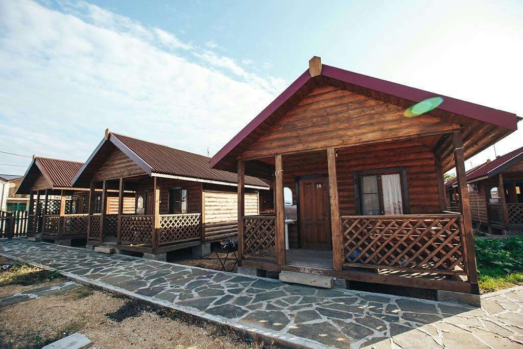
The best Russian resorts of the Caspian Sea are located in Dagestan.

Makhachkala, Kaspiysk, Izberbash, Lagan, Derbent, Dagestan Lights - famous seaside resort towns.
Climate
The coast of the Astrakhan region has a temperate climate. Warm weather lasts from the first days of May until the first half of September.
During the season, clear, warm weather prevails ( average temperature 24-25 0 C). Cloudy days and rain are rare.
Most hot month- July.

In summer, the sea water warms up to 23-28°C along the entire length of the Russian coastline.
Accommodation
There are more than 150 boarding houses and recreation centers on the Caspian coast of Russia.
Vacationers can buy a ticket in advance or register on the spot.

In Derbent and Kaspiysk, tourists will be warmly greeted by the staff of large, comfortable hotels.
Small cozy hotels are also available for vacationers. family vacation. You can find comfortable housing in the private sector. Prices are very affordable .
How to get there?
You can get to the Astrakhan coast of the Caspian Sea by the following route: by train or plane to the regional center of Astrakhan, and then by bus, taxi or water transport to your destination.
The resorts of Dagestan can be reached by local transport(bus, taxi) from the capital of the republic, Makhachkala, which can be reached by train or intercity bus.
Treatment
Those who wish can relax and undergo treatment at the Caspiy sanatorium, which is located on the seashore 40 km from Makhachkala.
This hydropathic clinic with healing mineral baths is equipped with modern diagnostic equipment.

The course of treatment is designed for 21 days, which gives a noticeable balneological effect.
Sanatorium "Lezzet"- climatic, sea, balneo-mud resort on the Caspian Sea. It is located 8 kilometers from Makhachkala airport.
Specialized areas: diseases of the nervous, musculoskeletal, genitourinary, digestive, cardiovascular, respiratory systems, gynecological problems and infertility.
The resort will help you combine seaside relaxation with treatment "Talgi". The health resort is located in Makhachkala.
Specialization: treatment and prevention of diseases of the joints, nervous and genitourinary systems. Unique sulfide waters with hydrogen sulfide are used for treatment.
Recreation and entertainment
All resorts and health resorts on the Russian coast have developed infrastructure and created conditions for a good rest:
- sports facilities;
- cafes, restaurants;
- various attractions;
- Boat trips, fishing, and thematic excursions are organized for those interested.

Holidays in the Astrakhan region
The city of Astrakhan is located in the Caspian lowland in the delta of the Volga River. This ancient city is part of tourist tours and is popular among travelers.
Guests are attracted by the wonderful architectural ensembles, majestic churches, interesting museums.
At the end of summer and autumn, you can enjoy the famous Astrakhan watermelons and fragrant melons from the garden.

From regional center The Caspian Sea is only 60 km away.
The most common and affordable housing for vacationers and tourists in the Volga delta and on the Caspian coast are recreation centers. As a rule, these are small cozy houses located in picturesque corners.
"Dardanelles", recreation center
The Astrakhan region is an excellent region for lovers of fishing and active recreation.
Fishermen have long chosen the Dardanelles recreation center, located in the Volga River delta.
In the modern building, the rooms are equipped with air conditioning, refrigerators, and bathrooms.

Dardanelles
For vacationers, high-quality meals are provided three times a day.
In the restaurant, the base can prepare delicious dishes from its own catch.
Vacationers have a sauna and billiards at their disposal. Guests are offered a variety of excursions, including to Astrakhan, boat trips on the sea and the Volga.
Address: s. Zaton, Kamyzyaksky district, Astrakhan region (base 9 km).
"Tortuga", fishing base
"Tortuga" in terms of cost of living is not very different from "Dardanelle".
A standard house has comfortable furniture, household appliances, necessary utensils, bathrooms. It is very comfortable for families with children to stay here.

Those who wish can stay in a floating house. The necessary fishing equipment can be rented on site.
Address: s. Vyshka, Limansky district, Astrakhan region.
Country of mountains - Dagestan- offers tourists the sandy beaches of the Caspian Sea, ski resorts, unique nature and culture, ancient monuments and wonderful national cuisine.

And although the idea of holidays in Dagestan is perceived ambiguously due to doubts about safety, many guests come to the republic. This mountain region is very beautiful and original.
Resort complex "Chindirchero"
This popular place holiday resort welcomes guests all year round.
In summer, guests can enjoy relaxing by the sea.
At the service of vacationers:
- windsurfing;
- kiting;
- rafting.

Chindirchero
All conditions for paragliding and rock climbing have also been created.
In winter, Chindirchero is a popular ski resort.
Address: s. Ginta, Akushinsky district, Makhachkala,
Derbent
Derbent, a city with a history of 5 thousand years, is one of the most attractive resorts for tourism on the shores of the Caspian Sea.
Derbent region is a subtropical paradise with the riot of nature and plenty of sun. Beauty sea coast framed by picturesque mountains.

Derbent has many ancient monuments and interesting sights. Vacationers can enjoy exciting excursions, including helicopter ones. There are hotels, inns, and tourist centers both in the city and in its surroundings.
The most popular hotels in Derbent:
- Hotel Krasny Bak;
- Hotel Complex Europe;
- Elit Hotel.
The resort can be reached by train or regular minibus from the bus station of Makhachkala or Kaspiysk. The Moscow - Baku train stops in Derbent.
Izberbash
This colorful city is located at the foothills of the Greater Caucasus, covered with picturesque forests.
Izberbash
The warm sea, extensive sandy beaches, and amazing landscapes attract tourists.
The combination of sea and mountain air and the presence of healing mineral springs make it possible to improve your health.
Tourist base "Priboy"
The windows of the three-story building of the tourist center offer magnificent views. The living rooms have all the necessary amenities, air conditioning and TVs. Vacationers have a clean, well-maintained beach at their disposal.

The camp site offers delicious, healthy food, a cozy bar, and a guarded parking lot.
Address: pos. Primorsky, Izberbash.
Reviews
“We came for the first time from Orenburg. Nature is simply a miracle! Everything is so beautiful – I didn’t part with my camera. The base itself is a most picturesque corner. Ideal place for relaxation. It’s a pity that we didn’t provide complete information and came for a three-day tour.
Next time we'll try to stay longer. Excellent service. Such hospitality and cordiality is rare to find. We left with great regret. We will definitely come back."
“There are beaches in Derbent. But most of them are rented from private owners. City beaches usually quickly fill with garbage and are poorly cleaned, and this fact does not even soften the charm of clear, beautiful, warm sea water.”
Resorts of Kazakhstan on the Caspian Sea
Amazing nature and warm healing water of the sea make holidays in the Caspian Sea very attractive.
People come to Kazakhstan to the coast to relax and improve their health. It offers comfortable sandy beaches, natural mineral springs and healing mud.

Aktau is the only city near the Caspian Sea in Kazakhstan.
On the Kazakh coast, the infrastructure is not yet very developed. However, there are already many pleasant places where tourists come with pleasure.
How to get there?
You can only get to Aktau by train or plane.
Getting there by road is difficult not only because of the very long distance, but also because of the quality of the local roads.
Climate
On the coast of the Caspian Sea, winters are mild and summers are dry and warm.
On a summer day, the air temperature rises to +30..+32 degrees, and at night drops to +20 degrees.
The beach season lasts from May to September.

Accommodation
There will be no problems with accommodation in Aktau, even if you do not come with a tour package. There are more than 20 modern comfortable hotels in the city.
The most popular of them:
- "Aktau";
- "Chagala" ;
- "Zheruyik."
Treatment
On the Kazakh shore of the Caspian Sea, two large medical and health complexes can be distinguished:
- “Kenderli” – 300 km from Aktau;
- Steagle, near the city.
The unique balneological hospital “Chagala” is located within the city.
Recreation and entertainment
"Kenderlik"
A sports and fitness complex is located near Aktau. It attracts lovers of active recreation.
This modern complex meets all international norms and standards.

Kenderli
Guests stay in small cozy cottages located on the shore or in comfortable hotel rooms, which include a sauna, indoor swimming pool, solarium and winter garden.
At the service of vacationers billiard room, gyms, tennis courts, outdoor summer swimming pool, football and volleyball courts, bowling alley, dance floor, bars and restaurant.
"Chagala", sanatorium
The sanatorium-preventorium “Chagala” (“Chaika”) offers quality rest and recreation. This is a unique balneological hospital. It is located on the shores of the Caspian Sea, within the city of Aktau.

Guests are offered one and double rooms with amenities. The sanatorium building has a comfortable winter garden where you can relax and admire exotic plants.
Vacationers can visit entertainment center, casino, technology park, roller skating area.
New impressions will be given sightseeing tours By historical places And natural monuments Mangyshlak.
Address: Aktau, mn 1, coastal zone.
On the seashore, 18 kilometers from Aktau, there is a modern sports and recreational entertainment center “Stigl”.
There are two hotels on the territory of the center. This complex is equipped in accordance with international standards.

On its territory there is a unique sea sauna, SPA salon, fitness center, massage rooms, as well as cafes, restaurants, and attractions.
The Caspian Sea is inland and located in a vast continental depression on the border of Europe and Asia. The Caspian Sea has no connection with the ocean, which formally allows it to be called a lake, but it has all the features of the sea, since in past geological eras it had connections with the ocean.
The sea area is 386.4 thousand km2, the volume of water is 78 thousand m3.
The Caspian Sea has a vast drainage basin, with an area of about 3.5 million km2. The nature of the landscapes, climatic conditions and types of rivers are different. Despite its vastness, only 62.6% of its area is in waste areas; about 26.1% - for non-drainage. The area of the Caspian Sea itself is 11.3%. 130 rivers flow into it, but almost all of them are located in the north and west (and the eastern coast does not have a single river reaching the sea). The largest river in the Caspian basin is the Volga, which provides 78% of the river waters entering the sea (it should be noted that more than 25% of the Russian economy is located in the basin of this river, and this undoubtedly determines many other features of the waters of the Caspian Sea), as well as the Kura River , Zhaiyk (Ural), Terek, Sulak, Samur.
Physiographically and by nature, the sea is divided into three parts: northern, middle and southern. The conventional border between the northern and middle parts runs along the line Chechen Island–Cape Tyub-Karagan, and between the middle and southern parts along the line Zhiloy Island–Cape Kuuli.
The shelf of the Caspian Sea is on average limited to depths of about 100 m. The continental slope, which begins below the shelf edge, ends in the middle part at approximately 500–600 m depths, in the southern part, where it is very steep, at 700–750 m.
The northern part of the sea is shallow, its average depth is 5–6 m, the maximum depths of 15–20 m are located on the border with the middle part of the sea. The bottom topography is complicated by the presence of banks, islands, and grooves.
The middle part of the sea is an isolated basin, the region of maximum depths of which - Derbent - is shifted to the western coast. The average depth of this part of the sea is 190 m, the greatest is 788 m.

The southern part of the sea is separated from the middle by the Absheron threshold, which is a continuation. The depths above this underwater ridge do not exceed 180 m. The deepest part of the South Caspian depression with a maximum sea depth of 1025 m is located east of the Kura delta. Several underwater ridges up to 500 m high rise above the bottom of the basin.
The shores of the Caspian Sea are diverse. In the northern part of the sea they are quite indented. Here are the Kizlyarsky, Agrakhansky, Mangyshlaksky bays and many shallow bays. Notable peninsulas: Agrakhansky, Buzachi, Tyub-Karagan, Mangyshlak. Large islands in the northern part of the sea are Tyuleniy and Kulaly. In the deltas of the Volga and Ural rivers, the coastline is complicated by many islands and channels, often changing their position. Many small islands and banks are located on other parts of the coastline.
The middle part of the sea has a relatively flat coastline. The Absheron Peninsula is located on the western coast, on the border with the southern part of the sea. To the east of it there are islands and banks of the Absheron archipelago, of which the largest island is Zhiloy. The eastern coast of the Middle Caspian is more indented; the Kazakh Gulf with Kenderli Bay and several capes stand out here. The largest bay of this coast is.

South of the Absheron Peninsula are the islands of the Baku archipelago. The origin of these islands, as well as some banks off the eastern coast of the southern part of the sea, is associated with the activity of underwater mud volcanoes lying on the seabed. On the eastern bank there are large bays Turkmenbashi and Turkmensky, and near it the island of Ogurchinsky.
One of the most striking phenomena of the Caspian Sea is the periodic variability of its level. In historical times, the Caspian Sea had a level lower than the World Ocean. Fluctuations in the level of the Caspian Sea are so great that for more than a century they have attracted the attention of not only scientists. Its peculiarity is that in the memory of mankind its level has always been below the level of the World Ocean. Since the beginning of instrumental observations (since 1830) of sea level, the amplitude of its fluctuations has been almost 4 m, from –25.3 m in the eighties of the 19th century. to –29 m in 1977. In the last century, the level of the Caspian Sea changed significantly twice. In 1929 it stood at about -26 m, and since it had been close to this level for almost a century, this level position was considered to be a long-term or secular average. In 1930 the level began to decline rapidly. By 1941 it had dropped by almost 2 m. This led to the drying out of vast coastal areas of the bottom. The decrease in level, with slight fluctuations (short-term slight rises in level in 1946–1948 and 1956–1958), continued until 1977 and reached a level of –29.02 m, i.e. the level reached its lowest position in history the last 200 years.

In 1978, contrary to all forecasts, sea level began to rise. As of 1994, the level of the Caspian Sea was at –26.5 m, that is, over 16 years the level rose by more than 2 m. The rate of this rise is 15 cm per year. The level increase in some years was higher, and in 1991 it reached 39 cm.
The general fluctuations in the level of the Caspian Sea are superimposed by its seasonal changes, the long-term average of which reaches 40 cm, as well as surge phenomena. The latter are especially pronounced in the Northern Caspian Sea. For the north west coast characterized by large surges created by prevailing, especially in the cold season, storms of eastern and southeastern directions. A number of large (more than 1.5–3 m) surges have been observed here over the past decades. A particularly large surge with catastrophic consequences was noted in 1952. Fluctuations in the level of the Caspian Sea cause great damage to the states surrounding its waters.


Climate. The Caspian Sea is located in temperate and subtropical climates. Climatic conditions change in the meridional direction, since the sea stretches from north to south for almost 1200 km.
Various circulation systems interact in the Caspian region, however, winds from eastern directions predominate throughout the year (influence of the Asian High). The position at fairly low latitudes provides a positive balance of heat influx, so the Caspian Sea serves as a source of heat and moisture for passing people most of the year. The average annual temperature in the northern part of the sea is 8–10°C, in the middle - 11–14°C, in the southern part - 15–17°C. However, in the northernmost areas of the sea, the average January temperature is from –7 to –10°C, and the minimum during invasions is up to –30°C, which determines the formation of ice cover. In summer, rather high temperatures dominate over the entire region under consideration - 24–26°C. Thus, the Northern Caspian is subject to the most dramatic temperature fluctuations.
The Caspian Sea is characterized by a very small amount of precipitation per year - only 180 mm, with most of it falling during the cold season of the year (from October to March). However, the Northern Caspian differs in this respect from the rest of the basin: here the average annual precipitation is lower (for the western part only 137 mm), and the seasonal distribution is more uniform (10–18 mm per month). In general, we can talk about proximity to arid ones.
Water temperature. The distinctive features of the Caspian Sea (large differences in depths in different parts of the sea, nature, isolation) have a certain influence on the formation of temperature conditions. In the shallow Northern Caspian Sea, the entire water column can be considered homogeneous (the same applies to shallow bays located in other parts of the sea). In the Middle and Southern Caspian Sea, surface and deep masses can be distinguished, separated by a transition layer. In the Northern Caspian and in the surface layers of the Middle and Southern Caspian, water temperatures vary over a wide range. In winter, temperatures vary from north to south from less than 2 to 10°C, the water temperature off the west coast is 1–2°C higher than that on the east, in the open sea the temperature is higher than at the coasts: by 2–3°C in the middle part and by 3–4°С in the southern part of the sea. In winter, the distribution of temperature with depth is more uniform, which is facilitated by winter vertical circulation. During moderate and severe winters in the northern part of the sea and shallow bays of the east coast, the water temperature drops to freezing temperature.

In summer, the temperature varies in space from 20 to 28°C. The highest temperatures are observed in the southern part of the sea; temperatures are also quite high in the well-warmed shallow Northern Caspian Sea. The zone where the lowest temperatures occur is adjacent to the east coast. This is explained by the rise of cold deep waters to the surface. Temperatures are also relatively low in the poorly heated deep-sea central part. In open areas of the sea, at the end of May–beginning of June, the formation of a temperature jump layer begins, which is most clearly expressed in August. Most often it is located between 20 and 30 m in the middle part of the sea and 30 and 40 m in the southern part. In the middle part of the sea, due to the surge off the eastern coast, the shock layer rises close to the surface. In the bottom layers of the sea, the temperature throughout the year is about 4.5°C in the middle part and 5.8–5.9°C in the southern part.
Salinity. Salinity values are determined by factors such as river flow, water dynamics, including mainly wind and gradient currents, the resulting water exchange between the western and eastern parts of the Northern Caspian and between the Northern and Middle Caspian, bottom topography, which determines the location of waters with different water, mainly along isobath, evaporation, providing a deficit of fresh water and an influx of saltier water. These factors collectively influence seasonal differences in salinity.
The Northern Caspian Sea can be considered as a constant mixing of river and Caspian waters. The most active mixing occurs in the western part, where both river and Central Caspian waters directly flow. Horizontal salinity gradients can reach 1‰ per 1 km.
The eastern part of the Northern Caspian is characterized by a more uniform salinity field, since most of the river and sea (Middle Caspian) waters enter this area of the sea in a transformed form.

Based on the values of horizontal salinity gradients, it is possible to distinguish in the western part of the Northern Caspian the river-sea contact zone with water salinity from 2 to 10‰, in the eastern part from 2 to 6‰.
Significant vertical salinity gradients in the Northern Caspian are formed as a result of the interaction of river and sea waters, with runoff playing a decisive role. The strengthening of vertical stratification is also facilitated by the unequal thermal state of the water layers, since the temperature of the surface desalinated waters coming from the seashore in summer is 10–15°C higher than the bottom waters.
In the deep-sea depressions of the Middle and Southern Caspian Sea, fluctuations in salinity in the upper layer are 1–1.5‰. The largest difference between the maximum and minimum salinity was noted in the area of the Absheron threshold, where it is 1.6‰ in the surface layer and 2.1‰ at a 5 m horizon.
The decrease in salinity along the western coast of the South Caspian Sea in the 0–20 m layer is caused by the flow of the Kura River. The influence of the Kura runoff decreases with depth; at horizons of 40–70 m, the range of salinity fluctuations is no more than 1.1‰. Along the entire western coast to the Absheron Peninsula there is a strip of desalinated water with a salinity of 10–12.5‰, coming from the Northern Caspian Sea.
In addition, in the Southern Caspian Sea, an increase in salinity occurs when salted waters are carried out from bays and bays on the eastern shelf under the influence of southeastern winds. Subsequently, these waters are transferred to the Middle Caspian Sea.
In the deep layers of the Middle and Southern Caspian Sea, the salinity is about 13‰. In the central part of the Middle Caspian, such salinity is observed at horizons below 100 m, and in the deep-water part of the Southern Caspian, the upper boundary of waters with high salinity drops to 250 m. Obviously, in these parts of the sea, vertical mixing of waters is difficult.
Surface water circulation. Currents in the sea are mainly wind-driven. In the western part of the Northern Caspian, currents of the western and eastern quarters are most often observed, in the eastern part - southwestern and southern ones. Currents caused by the runoff of the Volga and Ural rivers can be traced only within the estuary coastal area. Prevailing current speeds are 10–15 cm/s in open areas of the Northern Caspian Sea maximum speeds about 30 cm/s.
In the coastal areas of the middle and southern parts of the sea, in accordance with the wind directions, currents of the northwest, north, southeast and southern directions, currents often occur off the east coast east direction. Along the western coast of the middle part of the sea, the most stable currents are southeastern and southern. Current speeds are on average about 20–40 cm/s, with maximum speeds reaching 50–80 cm/s. Other types of currents also play a significant role in the circulation of sea waters: gradient, seiche, and inertial.

Ice formation. The Northern Caspian Sea is covered with ice every year in November, the area of the frozen part of the water area depends on the severity of the winter: in severe winters the entire Northern Caspian Sea is covered with ice, in mild winters the ice remains within 2–3 meter isobath. The appearance of ice in the middle and southern parts sea falls in December-January. On the eastern coast the ice is of local origin, on the western coast it is most often brought from the northern part of the sea. In severe winters, shallow bays freeze off the eastern coast of the middle part of the sea, shores and fast ice form off the coast, and on the western coast, drifting ice spreads to the Absheron Peninsula in abnormally cold winters. The disappearance of ice cover is observed in the second half of February–March.
Oxygen content. The spatial distribution of dissolved oxygen in the Caspian Sea has a number of patterns.
The central part of the waters of the Northern Caspian Sea is characterized by a fairly uniform distribution of oxygen. An increased oxygen content is found in the areas near the Volga River near the mouth, while a decreased oxygen content is found in the southwestern part of the Northern Caspian Sea.
In the Middle and Southern Caspian Sea, the highest concentrations of oxygen are confined to shallow coastal areas and pre-estuary coastal areas of rivers, with the exception of the most polluted areas of the sea (Baku Bay, Sumgait region, etc.).
In the deep-water areas of the Caspian Sea, the main pattern remains the same throughout all seasons - a decrease in oxygen concentration with depth.
Thanks to autumn-winter cooling, the density of the North Caspian Sea waters increases to a value at which it becomes possible for North Caspian waters with a high oxygen content to flow along the continental slope to significant depths of the Caspian Sea.
The seasonal distribution of oxygen is mainly associated with the annual course and seasonal relationship of production-destruction processes occurring in the sea.


In spring, the production of oxygen during photosynthesis very significantly covers the decrease in oxygen caused by a decrease in its solubility with increasing water temperature in spring.
In the areas of the coastal mouths of rivers feeding the Caspian Sea, in the spring there is a sharp increase in the relative oxygen content, which in turn is an integral indicator of the intensification of the photosynthesis process and characterizes the degree of productivity of the mixing zones of sea and river waters.
In summer, due to significant warming and activation of photosynthesis processes, the leading factors in the formation of the oxygen regime, in surface waters are photosynthetic processes, in benthic ones - biochemical oxygen consumption by bottom sediments.
Due to the high temperature of the waters, the stratification of the water column, the large influx of organic matter and its intense oxidation, oxygen is quickly consumed with minimal entry into the lower layers of the sea, resulting in the formation of an oxygen deficiency zone in the Northern Caspian Sea. Intensive photosynthesis in the open waters of the deep-sea regions of the Middle and Southern Caspian Sea covers the upper 25-meter layer, where oxygen saturation is more than 120%.

In autumn, in the well-aerated shallow areas of the Northern, Middle and Southern Caspian Sea, the formation of oxygen fields is determined by the processes of water cooling and the less active, but still ongoing process of photosynthesis. The oxygen content is increasing.
The spatial distribution of nutrients in the Caspian Sea reveals the following patterns:
- increased concentrations of nutrients are characteristic of areas near the mouth of the coastal rivers that feed the sea and shallow areas of the sea subject to active anthropogenic influence (Baku Bay, Turkmenbashi Bay, water areas adjacent to Makhachkala, Fort Shevchenko, etc.);
- Northern Caspian, which is vast area mixing of river and sea waters, characterized by significant spatial gradients in the distribution of nutrients;
- in the Middle Caspian, the nature of the circulation contributes to the rise of deep waters with a high content of nutrients into the overlying layers of the sea;
- in the deep-water regions of the Middle and Southern Caspian Sea, the vertical distribution of nutrients depends on the intensity of the convective mixing process, and their content increases with depth.
The dynamics of nutrient concentrations throughout the year in the Caspian Sea are influenced by such factors as seasonal fluctuations in nutrient runoff into the sea, the seasonal ratio of production-destructive processes, the intensity of exchange between soil and water mass, ice conditions in winter in the Northern Caspian, winter processes vertical circulation in deep sea areas.
In winter, a significant area of the Northern Caspian Sea is covered with ice, but biochemical processes actively develop in subglacial water and in ice. The ice of the Northern Caspian, being a kind of accumulator of nutrients, transforms these substances entering the sea from and from the atmosphere.
As a result of the winter vertical circulation of water in the deep-water regions of the Middle and Southern Caspian Sea during the cold season, the active layer of the sea is enriched with nutrients due to their supply from the underlying layers.
Spring for the waters of the Northern Caspian Sea is characterized by a minimum content of phosphates, nitrites and silicon, which is explained by the spring outbreak of phytoplankton development (silicon is actively consumed by diatoms). High concentrations of ammonium and nitrate nitrogen, characteristic of the waters of a large area of the Northern Caspian Sea during floods, are due to intensive washing by river waters.
In the spring season, in the area of water exchange between the Northern and Middle Caspian Seas in the subsurface layer, with a maximum oxygen content, the phosphate content is minimal, which, in turn, indicates the activation of the photosynthesis process in this layer.
In the Southern Caspian, the distribution of nutrients in spring is basically similar to their distribution in the Middle Caspian.
IN summer time in the waters of the Northern Caspian, a redistribution of various forms of biogenic compounds is detected. Here the content of ammonium nitrogen and nitrates decreases significantly, while at the same time there is a slight increase in the concentrations of phosphates and nitrites and a rather significant increase in the concentration of silicon. In the Middle and Southern Caspian Sea, the concentration of phosphates has decreased due to their consumption during photosynthesis and the difficulty of water exchange with the deep-sea accumulation zone.
In autumn in the Caspian Sea, due to the cessation of activity of some types of phytoplankton, the content of phosphates and nitrates increases, and the concentration of silicon decreases, as there is an autumn outbreak of the development of diatoms.
Oil has been extracted on the Caspian Sea shelf for more than 150 years.
Currently, large hydrocarbon reserves are being developed on the Russian shelf, the resources of which on the Dagestan shelf are estimated at 425 million tons in oil equivalent (of which 132 million tons of oil and 78 billion m3 of gas), on the shelf of the Northern Caspian Sea - at 1 billion tons of oil .
In total, about 2 billion tons of oil have already been produced in the Caspian Sea.
Losses of oil and its products during production, transportation and use reach 2% of the total volume.
The main sources of pollutants, including petroleum products, entering the Caspian Sea are removal with river runoff, discharge of untreated industrial and agricultural wastewater, municipal wastewater from cities and towns located on the coast, shipping, exploration and exploitation of oil and gas fields. located on the bottom of the sea, oil transportation by sea. Places of entry of pollutants with river runoff are 90% concentrated in the Northern Caspian Sea, industrial ones are confined mainly to the area of the Absheron Peninsula, and increased oil pollution of the Southern Caspian Sea is associated with oil production and oil exploration drilling, as well as with active volcanic activity(mud) in the zone of oil and gas bearing structures.
From the territory of Russia, about 55 thousand tons of petroleum products enter the Northern Caspian annually, including 35 thousand tons (65%) from the Volga River and 130 tons (2.5%) from the runoff of the Terek and Sulak rivers.
Thickening of the film on the water surface to 0.01 mm disrupts gas exchange processes and threatens the death of hydrobiota. The concentration of petroleum products is toxic to fish at 0.01 mg/l and to phytoplankton at 0.1 mg/l.

The development of oil and gas resources on the bottom of the Caspian Sea, the forecast reserves of which are estimated at 12–15 billion tons of standard fuel, will become the main factor in the anthropogenic load on the sea ecosystem in the coming decades.
Caspian autochthonous fauna. The total number of autochthons is 513 species or 43.8% of the entire fauna, which include herring, gobies, mollusks, etc.
Arctic species. The total number of the Arctic group is 14 species and subspecies, or only 1.2% of the entire Caspian fauna (mysids, sea cockroach, white fish, Caspian salmon, Caspian seal, etc.). The basis of the Arctic fauna are crustaceans (71.4%), which easily tolerate desalination and live at great depths of the Middle and Southern Caspian Sea (from 200 to 700 m), since the lowest water temperatures are maintained here throughout the year (4.9– 5.9°C).
Mediterranean species. These are 2 types of mollusks, needle fish, etc. At the beginning of the 20s of our century, the mollusk mytileaster entered here, later 2 types of shrimp (with mullet, during their acclimatization), 2 types of mullet and flounder. Some species entered the Caspian Sea after the opening of the Volga-Don Canal. Mediterranean species play a significant role in the food supply of fish in the Caspian Sea.

Freshwater fauna (228 species). This group includes anadromous and semi-anadromous fish (sturgeon, salmon, pike, catfish, carp, and also rotifers).
Marine species. These are ciliates (386 forms), 2 species of foraminifera. There are especially many endemics among higher crustaceans (31 species), gastropods (74 species and subspecies), bivalves (28 species and subspecies) and fish (63 species and subspecies). The abundance of endemics in the Caspian Sea makes it one of the most unique brackish bodies of water on the planet.
The Caspian Sea produces more than 80% of the world's sturgeon catches, the bulk of which occur in the Northern Caspian Sea.
To increase sturgeon catches, which sharply decreased during the years of falling sea levels, a set of measures is being implemented. Among them are a complete ban on sturgeon fishing in the sea and its regulation in rivers, and an increase in sturgeon factory farming.
This is how the Mediterranean Sea was formed, which then included the current Azov, Black and Caspian Sea. On the site of the modern Caspian Sea, a huge Caspian lowland was formed, the surface of which was almost 30 meters below the water level in the World Ocean. When did the next rise of land begin to take place at the place of formation? Caucasus Mountains, The Caspian Sea was finally cut off from the ocean, and in its place a closed, endorheic body of water was formed, which today is considered the largest inland sea on the planet. However, some scientists call this sea a giant lake.
A special feature of the Caspian Sea is the constant fluctuation in the salinity level of its water. Even in different areas of this sea, the water has different salinity. This was the reason that the Caspian Sea is dominated by animals of the classes of fish and crustaceans, which more easily tolerate fluctuations in water salinity.
Since the Caspian Sea is completely isolated from the ocean, its inhabitants are endermics, i.e. always live in its waters.
The fauna of the Caspian Sea can be divided into four groups.
The first group of animals includes the descendants of ancient organisms that inhabited Tethys about 70 million years ago. Such animals include Caspian gobies (bighead, Knipovich, Berg, bubyr, puglovka, Baer) and herring (Kessler, Brazhnikov, Volga, puzanok, etc.), some mollusks and most crustaceans (long-sex crayfish, Ortemia crustacean, etc.). Some fish, mainly herrings, periodically enter the rivers flowing into the Caspian Sea to spawn; many never leave the sea. Gobies prefer to live in coastal waters and are often found in river mouths.
The second group of animals of the Caspian Sea is represented by Arctic species. penetrated into the Caspian Sea from the north in the post-glacial period. These are animals such as the Caspian seal (Caspian seal), fish - Caspian trout, whitefish, nelma. Of the crustaceans, this group is represented by mysid crustaceans, similar to small shrimp, tiny sea cockroaches and some others.
The third group of animals inhabiting the Caspian Sea includes species that moved here independently or with the help of humans from Mediterranean Sea. These are mollusks mytisaster and abra, crustaceans - amphipods, shrimp, Black Sea and Atlantic crabs and some types of fish: singil (sharp fish), needle fish and Black Sea flounder (flounder).
And finally, the fourth group is freshwater fish that entered the Caspian Sea from fresh rivers and turned into marine or migratory fish, i.e. periodically rising into rivers. Some of the typically freshwater fish also sometimes enter the Caspian Sea. Among the fish of the fourth group are catfish, pike perch, barbel, red-lipped asp, Caspian fisherman, Russian and Persian sturgeon, beluga, stellate sturgeon. It should be noted that the Caspian Sea basin is the main habitat of sturgeon on the planet. Almost 80% of all sturgeon in the world live here. Barbel and vimba are also valuable commercial fish.
As for sharks and other fish that are predatory and dangerous to humans, they do not live in the Caspian Sea-lake.
Caspian Sea - the largest lake on Earth, endorheic, located at the junction of Europe and Asia, called a sea because of its size, as well as because its bed is composed of oceanic-type crust. The water in the Caspian Sea is salty, from 0.05 ‰ near the mouth of the Volga to 11-13 ‰ in the southeast. The water level is subject to fluctuations, according to 2009 data it was 27.16 m below sea level. The area of the Caspian Sea is currently approximately 371,000 km², the maximum depth is 1025 m.
Geographical location
The Caspian Sea is located at the junction of two parts of the Eurasian continent - Europe and Asia. The length of the Caspian Sea from north to south is approximately 1200 kilometers (36°34"-47°13" N), from west to east - from 195 to 435 kilometers, on average 310-320 kilometers (46°-56° c. d.). The Caspian Sea is conventionally divided according to physical and geographical conditions into 3 parts - the Northern Caspian, the Middle Caspian and the Southern Caspian. The conditional border between the Northern and Middle Caspian runs along the line of the island. Chechen - Cape Tyub-Karagansky, between the Middle and Southern Caspian Sea - along the line of the island. Residential - Cape Gan-Gulu. The area of the Northern, Middle and Southern Caspian Sea is 25, 36, 39 percent, respectively.
The length of the coastline of the Caspian Sea is estimated at approximately 6500-6700 kilometers, with islands - up to 7000 kilometers. The shores of the Caspian Sea in most of its territory are low-lying and smooth. In the northern part, the coastline is indented by water channels and islands of the Volga and Ural deltas, the banks are low and swampy, and the water surface in many places is covered with thickets. On east coast Limestone coasts predominate, adjacent to semi-deserts and deserts. The most winding shores are on the western coast in the area of the Absheron Peninsula and on the eastern coast in the area of the Kazakh Gulf and Kara-Bogaz-Gol. The territory adjacent to the Caspian Sea is called the Caspian region.
Peninsulas of the Caspian Sea
Large peninsulas of the Caspian Sea:
- Agrakhan Peninsula
- The Absheron Peninsula, located on the western coast of the Caspian Sea on the territory of Azerbaijan, at the northeastern end of the Greater Caucasus, on its territory are the cities of Baku and Sumgait
- Buzachi
- Mangyshlak, located on the eastern coast of the Caspian Sea, on the territory of Kazakhstan, on its territory is the city of Aktau
- Miankale
- Tyub-Karagan
Islands of the Caspian Sea
There are about 50 large and medium-sized islands in the Caspian Sea total area approximately 350 square kilometers. Largest islands:
- Ashur-Ada
- Garasu
- Boyuk-Zira
- Zyanbil
- Cure Dashi
- Khara-Zira
- Ogurchinsky
- Sengi-Mugan
- Seal
- Seal Islands
- Chechen
- Chygyl
Bays of the Caspian Sea
Large bays of the Caspian Sea:
- Agrakhan Bay
- Kizlyar Bay
- Dead Kultuk (formerly Komsomolets, formerly Tsesarevich Bay)
- Kaydak
- Mangyshlaksky
- Kazakh
- Kenderli
- Turkmenbashi (bay) (formerly Krasnovodsk)
- Turkmen (bay)
- Gizilagach (formerly Kirov Bay)
- Astrakhan (bay)
- Hasan-kuli
- Gizlar
- Hyrcanus (formerly Astarabad)
- Anzali (formerly Pahlavi)
- Kara-Bogaz-Gol
Rivers flowing into the Caspian Sea-130 rivers flow into the Caspian Sea, of which 9 rivers have a delta-shaped mouth. Large rivers flowing into the Caspian Sea are the Volga, Terek, Sulak, Samur (Russia), Ural, Emba (Kazakhstan), Kura (Azerbaijan), Atrek (Turkmenistan), Sefidrud (Iran) and others. The largest river flowing into the Caspian Sea is the Volga, its average annual flow is 215-224 cubic kilometers. The Volga, Ural, Terek, Sulak and Emba provide up to 88-90% of the annual flow into the Caspian Sea.
Physiography
Area, depth, volume of water- the area and volume of water in the Caspian Sea varies significantly depending on fluctuations in water level. At a water level of −26.75 m, the area is approximately 371,000 square kilometers, the volume of water is 78,648 cubic kilometers, which is approximately 44% of the world's lake water reserves. The maximum depth of the Caspian Sea is in the South Caspian depression, 1025 meters from its surface level. In terms of maximum depth, the Caspian Sea is second only to Baikal (1620 m) and Tanganyika (1435 m). The average depth of the Caspian Sea, calculated from the bathygraphic curve, is 208 meters. At the same time, the northern part of the Caspian Sea is shallow, its maximum depth does not exceed 25 meters, and the average depth is 4 meters.
Water level fluctuations- the water level in the Caspian Sea is subject to significant fluctuations. According to modern science, over the past three thousand years, the magnitude of the change in the water level of the Caspian Sea has reached 15 meters. According to archeology and written sources, a high level of the Caspian Sea is recorded at the beginning of the 14th century. Instrumental measurements of the level of the Caspian Sea and systematic observations of its fluctuations have been carried out since 1837, during which time the highest water level was recorded in 1882 (−25.2 m), the lowest in 1977 (−29.0 m), with Since 1978, the water level has risen and in 1995 reached −26.7 m; since 1996, a downward trend has emerged again. Scientists associate the reasons for changes in the water level of the Caspian Sea with climatic, geological and anthropogenic factors. But in 2001, sea level began to rise again, and reached −26.3 m.
Water temperature- water temperature is subject to significant latitudinal changes, most clearly expressed in winter, when the temperature varies from 0-0.5 °C at the ice edge in the north of the sea to 10-11 °C in the south, that is, the difference in water temperature is about 10 ° C. For shallow areas with depths less than 25 m, the annual amplitude can reach 25-26 °C. On average, the water temperature off the west coast is 1-2 °C higher than that on the east, and in the open sea the water temperature is 2-4 °C higher than off the coasts.
Water composition- the salt composition of the waters of the closed Caspian Sea differs from the oceanic one. There are significant differences in the ratios of concentrations of salt-forming ions, especially for waters in areas directly influenced by continental runoff. The process of metamorphization of sea waters under the influence of continental runoff leads to a decrease in the relative content of chlorides in the total amount of salts of sea waters, an increase in the relative amount of carbonates, sulfates, calcium, which are the main components in the chemical composition of river waters. The most conservative ions are potassium, sodium, chlorine and magnesium. The least conservative are calcium and bicarbonate ions. In the Caspian Sea, the content of calcium and magnesium cations is almost two times higher than in the Sea of Azov, and the sulfate anion is three times higher.
Bottom relief- the relief of the northern part of the Caspian Sea is a shallow undulating plain with banks and accumulative islands, the average depth of the Northern Caspian Sea is 4-8 meters, the maximum does not exceed 25 meters. The Mangyshlak threshold separates the Northern Caspian from the Middle Caspian. The Middle Caspian is quite deep, the water depth in the Derbent depression reaches 788 meters. The Absheron threshold separates the Middle and Southern Caspian Seas. The Southern Caspian is considered deep-sea; the water depth in the South Caspian depression reaches 1025 meters from the surface of the Caspian Sea. Shell sands are widespread on the Caspian shelf, deep-sea areas are covered with silty sediments, and in some areas there is an outcrop of bedrock.
Climate- the climate of the Caspian Sea is continental in the northern part, temperate in the middle and subtropical in the southern part. In winter average monthly temperature air varies from −8…−10 in the northern part to +8…+10 in the southern part, in summer - from +24…+25 in the northern part to +26…+27 in the southern part. The maximum temperature of +44 degrees was recorded on the east coast. The average annual precipitation is 200 millimeters, ranging from 90-100 millimeters in the arid eastern part to 1,700 millimeters along the southwestern subtropical coast. Evaporation of water from the surface of the Caspian Sea is about 1000 millimeters per year, the most intense evaporation in the area of the Absheron Peninsula and in the eastern part of the South Caspian Sea is up to 1400 millimeters per year. The average annual wind speed is 3-7 meters per second, the wind rose is dominated by north winds. In the autumn and winter months, winds become stronger, with wind speeds often reaching 35-40 meters per second. The most windy areas are the Absheron Peninsula, the environs of Makhachkala and Derbent, where the highest wave of 11 meters was recorded.
Currents- water circulation in the Caspian Sea is associated with drainage and winds. Since most of the drainage occurs in the Northern Caspian Sea, northern currents predominate. An intense northern current carries water from the Northern Caspian along the western coast to the Absheron Peninsula, where the current divides into two branches, one of which moves further along the western coast, the other goes to the Eastern Caspian.
Economic development of the Caspian Sea
Oil and gas production-Many oil and gas fields are being developed in the Caspian Sea. Proven oil resources in the Caspian Sea are about 10 billion tons, total oil and gas condensate resources are estimated at 18-20 billion tons. Oil production in the Caspian Sea began in 1820, when the first oil well was drilled on the Absheron shelf near Baku. In the second half of the 19th century, oil production began on an industrial scale on the Absheron Peninsula, and then in other territories. In 1949, oil production from the bottom of the Caspian Sea began for the first time at Neftyanye Kamni. So, on August 24 of this year, Mikhail Kaverochkin’s team began drilling a well, which yielded the long-awaited oil on November 7 of the same year. In addition to oil and gas production, salt, limestone, stone, sand, and clay are also mined on the coast of the Caspian Sea and the Caspian shelf.
Shipping- Shipping is developed in the Caspian Sea. On the Caspian Sea there are ferry crossings, in particular, Baku - Turkmenbashi, Baku - Aktau, Makhachkala - Aktau. The Caspian Sea has a shipping connection with Sea of Azov through the Volga, Don and Volga-Don Canal rivers.
Fishing and seafood production-fishing (sturgeon, bream, carp, pike perch, sprat), caviar production, as well as seal fishing. More than 90 percent of the world's sturgeon catch occurs in the Caspian Sea. In addition to industrial mining, illegal fishing of sturgeon and their caviar flourishes in the Caspian Sea.
Legal status of the Caspian Sea- after the collapse of the USSR, the division of the Caspian Sea for a long time was and still remains the subject of unresolved disagreements related to the division of the resources of the Caspian shelf - oil and gas, as well as biological resources. For a long time, negotiations were ongoing between the Caspian states on the status of the Caspian Sea - Azerbaijan, Kazakhstan and Turkmenistan insisted on dividing the Caspian along the median line, Iran insisted on dividing the Caspian one-fifth between all Caspian states. The current legal regime of the Caspian was established by the Soviet-Iranian treaties of 1921 and 1940 These treaties provide for freedom of navigation throughout the sea, freedom of fishing with the exception of ten-mile national fishing zones and a ban on vessels flying the flag of non-Caspian states sailing in its waters. Negotiations about legal status The Caspian Sea is currently ongoing.


